Image
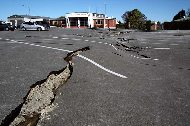
This image gives some sense of the scale of the damage in Kaiapoi following the earthquake on 4 September 2010. There was much damage to buildings and infrastructure, with over half the sewers unable to be used and 22 buildings considered too dangerous to enter.
Te whakamahi i tēnei tūemi
Private collection
by Melissa Jemmett
This item has been provided for private study purposes (such as school projects, family and local history research) and any published reproduction (print or electronic) may infringe copyright law. It is the responsibility of the user of any material to obtain clearance from the copyright holder.