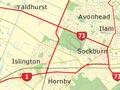
Belfast
Northern suburb that was for a long time a separate town. It developed when Canterbury’s first meat-freezing works were built there in 1883. The freezing works remain. In 2013 the population was 7,809, a 21% increase since 2006, partly because apart from some minor liquefaction, damage in the Canterbury earthquakes was minimal.
Christchurch International Airport
International and domestic airport at Harewood, a locality on the outskirts of Christchurch. In 1935 the Christchurch City Council bought land there for a municipal airport, opened in 1940. Through most of the Second World War, Harewood was an air force base. It later became Christchurch Airport. International flights began in 1950, and the airport was New Zealand’s first served by international jet planes in 1965.
Papanui
Northern suburb between Merivale and Bishopdale. From 1850 the sawmilling village of Papanui developed beside a rare patch of native forest, which was quickly cut out for timber and firewood. Papanui then became a residential and commercial village. Tramlines arrived in 1880 and there was a Papanui railway station on the main north line. Since the 1950s suburbs have sprung up beyond Papanui and Northcote, which were once on the city limits.
Bryndwr
Suburb between Papanui and Fendalton, where large tracts of state housing were built after the Second World War. It includes an industrial zone for electronics companies.
Merivale
Suburb adjoining the northern boundary of Hagley Park. Merivale was fashionable from the 1860s. In the 1990s, rising land values led to a burst of subdivision and infill housing. Merivale's shopping centre on Papanui Road was badly damaged in the February 2011 earthquake, and St Mary's Anglican church (built in 1926) was demolished.
St Albans
One of the city’s largest inner suburbs, between Merivale and Richmond. Originally a working-class settlement, it was a separate borough from 1881 until 1903, when it became part of Christchurch City. The suburb was badly hit in the February 2011 earthquake, with much liquefaction, and building damage which resulted in the demolition of houses and shops. Lowered ground levels produced chronic flooding in the Flockton Basin.
Fendalton
The most expensive of Christchurch’s suburbs. Through the late 19th and early 20th centuries fashionable houses were built there. The main route to Christchurch airport runs through its centre.
Ilam
Suburb on the banks of the Ilam and Waimairi streams. ‘Ilam’ was one of the homesteads on the large holdings that ringed early Christchurch. A new Ilam campus for the University of Canterbury was planned in 1949, but the move was not completed until 1975.
Riccarton
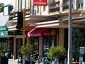
Suburb by western Hagley Park. It extends to Church Corner (Upper Riccarton), where the main roads south and west of Christchurch diverge. Lower Riccarton is a shopping centre along Riccarton Road. The city’s first major shopping mall (now Westfield Mall) was built there in 1965. With the closure of the central city following the February 2011 earthquake, Westfield Mall became a major shopping centre for the city, and traffic on Riccarton Road became very heavy.
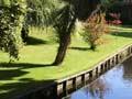
Riccarton Bush (also known as Deans Bush) is the only surviving swamp forest on the Canterbury Plains. In 1843 the Deans brothers established a farm on the edge of the area, now a public reserve. The Deans’s cottage (1843) and house are publicly owned.
Aviation milestones
In 1928 Charles Kingsford Smith landed his plane, the Southern Cross, at Wigram airport after making the first flight to New Zealand from Australia. In 1953 Christchurch airport was the finishing line for the London–Christchurch international race, the last of its kind.
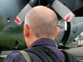
Sockburn
Residential and industrial suburb between Upper Riccarton and Hornby. Aviation promoter Henry Wigram established a flying school there in 1916. The landing field was named Wigram Aerodrome when the government bought the school and airfield in 1923. Wigram was a Royal New Zealand Air Force base until 1995. The Air Force Museum remains on the site.
Hornby
This western industrial suburb began as a village where the railways to Southbridge and Little River left the main line. It now has a major shopping centre. Local freezing works and glass works have closed, but the fertiliser works remain.