


Sefton
Small rural service town 12 km north-east of Rangiora. Sefton for a time was a centre of dairying. Today a particle-board manufacturing plant dominates the district. In 2013 the town had a population of 624.
Loburn
Farming locality 11 km north of Rangiora. Small orchards planted between 1914 and 1916 made it one of Canterbury’s few fruit-growing areas. The orchards that survived beyond the Second World War flourished in the 1950s, but today only the church, domain (public park) and hall remain.
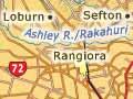
Rangiora
Principal town of North Canterbury, 11 km north-west of Kaiapoi and 27 km north of Christchurch. Rangiora lies between the Waimakariri and Ashley rivers, inland from State Highway 1 but on the main north railway line.
Starting in 1852 as a sawmilling town, Rangiora became the administrative and commercial centre for a large area of farms and orchards. It attracted residents commuting to Christchurch for work, with the population more than doubling from 1971 to 2006. Although the town suffered some damage in both the 2010 Darfield and 2011 Christchurch earthquakes (the major department store Farmers was lost), there was less damage than further south, which encouraged new residents. The 2013 population of 13,332 was a 12% increase on 2006.
Rangiora has some historic buildings, including the Anglican Church of St John the Baptist – one of Canterbury’s largest and most beautiful wooden churches, designed by Benjamin Mountfort. Heritage buildings demolished after the earthquakes included the 1882 Masonic Lodge.
Cust
Township 17 km west of Rangiora, named after General Sir Edward Cust, a founding member of the Canterbury Association. Cust developed in the 1860s as a rural service town. A church from that time is one of the town’s historic buildings. In 2013 Cust had a population of 447.
Whipping up a treat
Littledene, a study published in 1938, discusses the importance of food and baking in country towns at the time: ‘The farm wife takes a pint of cream, six eggs and the spur of the moment while the meat and potatoes are cooking – and lo! – a cream-sponge-cake six inches high, with two inches of whipped cream in its depth. The cookery section of the Littledene Agricultural and Pastoral Show is like a confectioner’s heaven.’ 1
Oxford
Town 33 km west of Rangiora, with a 2013 population of 1,905. Close to once-forested foothills, Oxford started in the early 1850s as a sawmilling town. In the 1870s, 11 mills were operating. A major fire in 1898 curtailed milling and the last mill closed in 1912. The town survived as a rural service and retirement centre. Crawford and Gwen Somerset did pioneering social research there in the 1930s, referring to it as ‘Littledene’.
Puketeraki Range
One of the major foothill ranges of North Canterbury. Rivers to the east of the range flow directly onto the Canterbury Plains. Those to the west form northern tributaries of the Waimakariri River above its gorge.