Porters Pass
Pass between the Torlesse and Big Ben ranges. The road from Canterbury to the West Coast turns up the Kowai River into the hills just beyond Springfield, crossing Porters Pass into the Castle Hill Basin. The pass was named in 1858 after the Porter brothers, who had a high-country run nearby.
Torlesse Range
One of the best known of the foothill ranges, clearly visible from Christchurch and lying immediately ahead of travellers on the main road west. It is named after one of the Canterbury Association surveyors who laid out the Canterbury settlement. Its highest peak is Castle Hill Peak (1,996 m). The range separates the Castle Hill Basin from the plains. Much of the range has been included in Korowai–Torlesse Tussockland Park.
State Highway 73
Road crossing Porters and Arthur’s passes. Much of what is now State Highway 73 was built in 1865–66 to connect Canterbury to the West Coast goldfields. Horse-drawn coach services continued to cross Arthur’s Pass until the Ōtira tunnel opened in 1923.
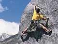
Castle Hill
Castle Hill, which has spectacular limestone outcrops, lies between the Torlesse and Craigieburn ranges, and is crossed by State Highway 73. It is popular among rock climbers, and known for its rare native plant life. Castle Hill Peak rises 921 m above the surrounding rocks.
In 2004 part of Castle Hill Station was purchased by the Department of Conservation to link Craigieburn Forest Park to Korowai–Torlesse Tussockland Park. Broken River drains the basin into the gorge of the Waimakariri River.
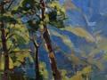
Craigieburn Range
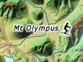
One of the major foothill ranges of the Southern Alps, between the Castle Hill Basin and the upper Waimakariri and Harper rivers. In basins with winter snow there are several small skifields developed by Christchurch clubs (Mt Cheeseman, Broken River, Craigieburn and Olympus), and a commercial field (Porter Heights). Craigieburn Forest Park protects beech forest on the range.
Ōtira Tunnel
Railway tunnel beneath the Southern Alps, giving an alternative route through Arthur’s Pass to Ōtira near the West Coast. The eastern entrance of the 8.5-km tunnel is across the Bealey River from the Arthur’s Pass township. The tunnel was begun in 1908. Breakthrough came in 1918 but the tunnel did not open until 1923. It was important because it allowed West Coast coal and timber to be brought east. The tunnel slopes steeply from the Arthur’s Pass end down to the Ōtira end.
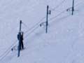
Skifields
Many long-established skifields can be visited from Christchurch. Some were set up by ski clubs, but can be used by members of the public. Temple Basin skifield, high in Arthur’s Pass National Park, dates back to 1929.
Arthur’s Pass
Pass over the Southern Alps between the headwaters of the Ōtira River and the Bealey River. Its summit marks the boundary between Canterbury and the West Coast.
The pass was used by Māori parties bringing pounamu (greenstone) across the Southern Alps. Crossed in 1864 by Arthur Dobson, after whom it was named, it was chosen for the road to the West Coast goldfields the following year. The road was opened in 1866. Later the Ōtira tunnel took the railway line beneath the Pass.
The township developed from around 1908 as a construction camp for the tunnel. Some of the iron huts remain as holiday homes.
The headquarters of Arthur’s Pass National Park (created in 1929, originally 48,600 ha but now 118,472 ha) are in the town. The eastern parts of the park support native beech forests. The highest peak in the park, Mt Murchison (2,400 m) is at the headwaters of the Waimakariri River. The prominent peak just west of the pass is Mt Rolleston (2,270 m). Above the pass is the Temple Basin ski ground.