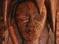

Waka traditions
The King Country has important associations with the Tainui waka (canoe), one of many which brought the ancestors of Māori to New Zealand from East Polynesia. Tainui, captained by Hoturoa, landed at Mōkau, where some of the crew disembarked. The waka was buried at Kāwhia. Through this ancestral connection with Hoturoa, Ngāti Maniapoto belong to the Tainui confederation of tribes.
Rescue effort
The Tainui’s anchor stone lay untouched on a sandspit at the mouth of the Mōkau River until 1894, when it was removed by the European owner of a cutter (small ship), who took it to his home in Waitara. Its absence was soon noted and suspicion fell on the culprit. He was confronted by Te Horo, a chief, and the surveyor and ethnographer William Skinner. They arranged for the anchor to be returned to the Mōkau River. In 1926 it was placed within the more secure grounds of the urupā (cemetery) at Maniaroa marae, near Awakino.
People from the Aotea waka visited Kāwhia on foot before travelling south to the Pātea River, where they settled. The Tokomaru waka stopped at Mōkau and some of the crew disembarked to continue their journey overland.
Ngāti Maniapoto
Ngāti Maniapoto is the main iwi (tribe) of the King Country. The iwi is named after the ancestor Maniapoto, a 17th-century descendant of Hoturoa.
Maniapoto’s great-grandfather Tūrongo was given land south of the Pūniu River, the waterway which later became the iwi’s northern boundary. The Mōkau River formed the southern boundary.
Maniapoto inherited the mana over these lands on the death of his father Rereahu, Tūrongo’s grandson. His older half-brother, Te Ihingaarangi, challenged Maniapoto but was defeated, which confirmed Maniapoto’s leadership.
In 2006 just over 33,600 people identified themselves as Ngāti Maniapoto, which made it the seventh-largest iwi in New Zealand. Most of them lived outside the King Country.
Other iwi
Oher tribes with affiliations to the region include Ngāti Mahuta of Tainui on the Kāwhia Harbour, Ngāti Raukawa in the north-east around Wharepūhunga, and Ngāti Tama in the south-west around Mōkau. Ngāti Hauā, a Waikato iwi, has interests south of the Pūniu River, near the region’s northern boundary, and the Whanganui and Ngāti Tūwharetoa people have interests around Taumarunui. The volcanic mountains in the south are of great cultural and spiritual importance to Ngāti Tūwharetoa.
Settlement
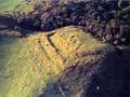
Major Māori settlements were on the west coast and along rivers. Kāwhia in the north and Mōkau in the south were important locales. They were on water- and track-based transport routes and had abundant food. At Kāwhia, Ngāti Toa (who descended from the Tainui waka) occupied the northern part of the harbour, while Ngāti Maniapoto settled the southern part. At Mōkau, Ngāti Maniapoto intermarried with Ngāti Tama of Taranaki, though the two groups also fought over land and resources.
The coast between Kāwhia and Mōkau comprises tall, broken cliffs and scattered beaches and was sparsely settled. Kāinga (villages) were established on Lake Taharoa and the Marokopa River in the north, and on the Waikawau and Awakino rivers further south.
There were also settlements further inland. The Waipā River valley was an important area of settlement – Maniapoto himself grew up at Te Kūiti. The confluence of the Whanganui and Ōhura rivers at Taumarunui was another populated place.
Conflict
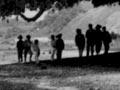
The early 19th century was a time of inter-tribal conflict triggered by the arrival of Europeans and access to muskets. War parties moving up and down the North Island travelled through the King Country, mainly down the west coast and along the Mōkau River. In the 19th century Ngāti Maniapoto joined their traditional Waikato allies to fight battles in Waikato against Ngāti Toa and the invading Ngāpuhi, and against Ngāti Tama in Taranaki.
In 1820 thousands of Waikato and Ngāti Maniapoto warriors attacked Kāwhia. They defeated Ngāti Toa, led by Te Rauparaha, during a major battle near Lake Taharoa, south of Kāwhia Harbour. This contributed to Ngāti Toa’s migration south along the King Country coast, through Taranaki and eventually to Kāpiti.
Waikato and Ngāti Maniapoto were not immune from attack. In 1822 Waikato and Ngāti Maniapoto forces were routed by musket-bearing Ngāpuhi in a battle near Pirongia. Pōtatau Te Wherowhero of Waikato, who was later to become the Māori king, took his people into the upper Mōkau River district, where they lived for several years.
Birthplace of a king
The second Māori king, Tāwhiao, was born at Ōrongokoekoeā, a Ngāti Maniapoto pā near the upper Mōkau River, south of modern-day Te Kūiti. Ōrongokoekoeā was well known for its great gong, which was struck in times of war.
In the late 1820s and early 1830s, now armed with muskets, Waikato and Ngāti Maniapoto raided Taranaki. These raids devastated the northern Taranaki communities and the people joined Ngāti Toa in Kāpiti. Te Wherowhero made peace with Taranaki in 1836, but this was not recognised by Ngāti Maniapoto, who made their final raid in 1837. By this time, European traders and missionaries had arrived in the region.