

The government ‘opened’ land for farming settlements from the early 1890s. Much of this land was initially leased by Māori rather than sold. Māori also developed farms. Returned servicemen were settled on farms after both world wars.
Farm types
Pastoral farming was the main form of agriculture. Sheep predominated, followed by dairy cows and beef cattle. Dairy farms were established where the land was flat enough, while sheep and cattle were farmed on hillier country.
Agricultural processing
Dairy factories opened in the King Country from the early 1900s. The smaller factories closed as road transport improved in the 1920s and 1930s – milk could be taken to larger, more advanced factories further afield. After the Second World War processing was concentrated in these larger factories, and eventually moved out of the region altogether. In 2011 the closest factories were in Taranaki and Waikato. Freezing works were located in Te Kūiti and Benneydale.
Farming problems
Forests were burned by early settlers to create farmland. The ash improved the fertility of the soil, but this boost was temporary. Poor fertility, the enlistment of farmers for the First World War, an economic slump in the early 1920s and the depression of the 1930s led to widespread reversion of farmland to scrub and bush.
Local ailment
Bush sickness had a number of local names. The King Country’s version – Mairoa dopiness or disease – referred to the settlement of Mairoa, south-west of Te Kūiti, where the problem was particularly bad. It was also known as Morton Mains disease in Southland and the Glenhope ailment in Nelson.
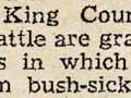
Another problem was ‘bush sickness’. Animals which grazed on the volcanic pumice soils common in the region wasted away and died unless they were moved to pasture growing on different soil. The cause – cobalt deficiency – was discovered in 1935.
Māori farming schemes
From the late 1920s the government provided Māori land owners with funds to develop their holdings into farms. Such assistance had previously been available only to European farmers. At Waimiha, north-east of Taumarunui, for example, dairy farms of around 150 hectares were established in the 1930s. Some were later sold and others consolidated into larger holdings.
Farming success
By the Second World War, superphosphate fertiliser (with cobalt added) was widely applied to farmland, which resolved soil fertility and mineral-deficiency problems. The Land Development Branch of the Department of Lands and Survey brought reverted farmland back into production. After the Second World War returned servicemen were settled on the farms. From the 1950s aerial fertiliser topdressing significantly increased farm productivity.
Forestry
Kahikatea (white pine) was exported from Kāwhia from the 1840s until the region was closed to Europeans in the 1860s.
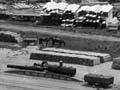
Commercial sawmilling operations were established after the main trunk line reached Ōtorohanga in 1887. Most were small operations serving the local market. However, one of the largest sawmilling businesses in New Zealand, Ellis and Burnand, operated in the King Country.
Taumarunui became the regional sawmilling centre after the railway reached the town in 1903, and the industry developed further once the entire line was completed in 1908.
Mill townships such as Mangapēhi and Ōngarue were bustling places when the mills were operating. Sawmilling provided a livelihood for many King Country residents and the sounds and smells of the mills were a distinctive part of everyday life.
Milling of indigenous timber peaked in the 1950s. In the later 20th century timber supplies were much diminished, and the small mills which had characterised the industry closed. In the late 1970s state-owned forests such as Pureora were protected for scientific and environmental reasons. Logging in Pureora ceased permanently in 1982.
Exotic forests
Exotic forests (mainly radiata pine) were established by the government Forest Service at Erua in 1930 and Pureora in 1949. By the 1970s large stands of exotic trees had been established in the vicinity of Pureora. In the 2000s most of the exotic forests were in the east of the region, around Pureora and Benneydale.
Coal spotter
Ernst Dieffenbach, the naturalist for the New Zealand Company, was probably the first European to note the existence of coal at Mōkau. Dieffenbach travelled there in 1840 during a trip along the west coast of the North Island and into the volcanic region in the interior.
Mining
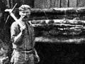
Coal deposits were observed in the sedimentary rocks around Mōkau in 1840. Extraction began in the 1880s and continued around Ōhura until 1990, when the last mine of the Waitewhena coalfield closed. Further north, coal was mined at Āria and Benneydale. The Benneydale mine was worked from 1931 to 1962, and a new part of the seam was mined on a smaller scale between 1978 and 1998.
Ironsand has been mined at Taharoa, near Kāwhia, since 1972.
Limestone extraction
High-grade limestone deposits are located in the northern King Country. The first limestone quarry was opened near Te Kūiti in 1898. Lime was used for agricultural purposes and demand grew with European settlement, leading to more quarries opening in the district.
In the 2000s there were major limestone processing plants near Te Kūiti and Ōtorohanga. Limestone was also taken from the Te Kumi quarry, near Te Kūiti. A limestone and serpentine quarry was located at Āria.