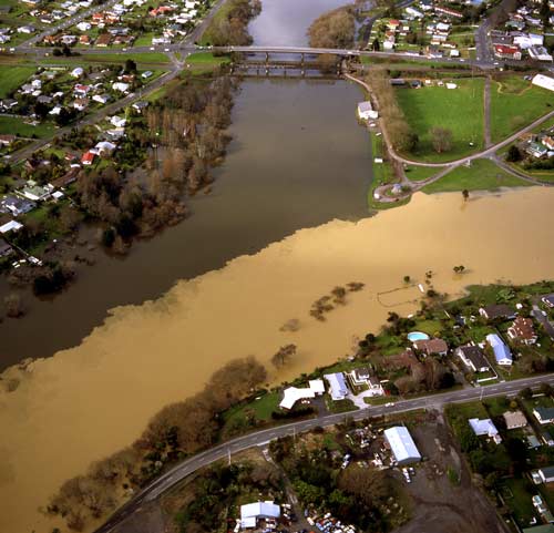
An aerial photograph of Ngāruawāhia in July 1998 shows very clearly one of the consequences of flooding, as sediment-laden waters from the Waipā River (right) mingle with the Waikato River. Farming has contributed to the flooding of the river systems in the past 120 years. Removal of vegetation increased erosion and run-off, and swamp drainage reduced ponding areas, leading to serious floods in the lower reaches of the river from the late 19th century. Planting vegetation and creating reserves in the upper reaches are among the measures taken to reduce the risk.
Te whakamahi i tēnei tūemi
J Greenwood Photography
by John Greenwood
This item has been provided for private study purposes (such as school projects, family and local history research) and any published reproduction (print or electronic) may infringe copyright law. It is the responsibility of the user of any material to obtain clearance from the copyright holder.