
Memorial Park
Park downstream from Victoria Bridge. In 1864 Hamilton’s first militia settlers landed on this site. On the riverbank is the hulk of the paddle steamer Rangiriri, which brought them upstream. Used by British forces during the Waikato war, it was later a cargo boat. The park and cenotaph were created in memory of First World War soldiers.
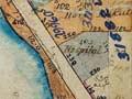
Miropiko pā
Remains of a large Māori fortification beside River Road, upstream from Whitiora Bridge. Miropiko is the best preserved of a number of pā sites on both river banks.
Irishtown
From the 1870s until the mid-20th century, Hamilton East was sometimes known as ‘Irishtown’. A significant number of the militiamen who settled there were of Irish descent, and many other Irish Catholics came to live near the Catholic church and convent.
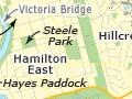
Hamilton East
Suburb 2 km south-east of the city centre. At its centre is Steele Park, named for militia officer William Steele. It was originally called Sydney Square, after the New South Wales city where members of the 4th Waikato militia enlisted. The oaks around its perimeter were planted in 1889, the silver jubilee of the arrival of militia settlers.
Reminders of a strong Irish Catholic presence include the Cathedral of the Blessed Virgin Mary, which replaced the 1912 church in the 1980s, the convent of the Institute de Notre Dames des Missions and Sacred Heart Girls’ College.
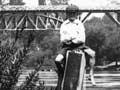
Hamilton bridges
Six bridges across the river link Hamilton East and Hamilton West.
- The Claudelands combined rail-and-road bridge was built to carry rail traffic only, in 1884. A pedestrian bridge was added in 1908. In 1964, when the railway line across Victoria St was put underground, the rail bridge was converted to a traffic and pedestrian bridge, and a lower-level rail bridge was built alongside.
- The steel Victoria Bridge, linking Hamilton East with southern Victoria St, was constructed in 1910 to replace the 1878 Union Bridge.
- Fairfield Bridge, with its gracious concrete arches, opened in 1937. The discovery in 1980 that it had ‘concrete cancer’ prompted extensive repairs.
- Cobham Bridge opened in 1963 as part of a motorway development linking the central city with State Highway 1 south.
- Whitiora Bridge, also known as the Boundary Road bridge, opened in 1978 to ease traffic congestion in the city centre.
- Pukete Bridge opened in 1996, and has become part of the Wairere Drive motorway development through Hamilton’s expanding northern suburbs.
Hamilton Gardens
Public gardens upstream from Cobham Bridge, covering 58 hectares. They were developed from the 1980s in stages, with paradise, productive, cultivar and landscape collections. The much-praised paradise collection includes a Chinese scholar’s garden, an English flower garden, a Japanese garden of contemplation, an American modernist garden, an Italian Renaissance garden and an Indian char bagh garden. A woven Hinuera stone cloak sculpture at the main entrance, ‘Ngā Uri o Hinetuparimaunga’ (earth blanket), honours natural creative processes.
Hayes Paddock
Thanks to Hamilton heritage enthusiasts, an area of state housing in Hamilton East, constructed between 1939 and 1945, has received protection in the city’s district plan. The enclave, known as Hayes Paddock, contains over 200 classic state houses built along seven streets named after governors-general.
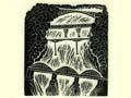
Claudelands Reserve
Site of the Claudelands Showgrounds and the Waikato Events Centre, between Heaphy Terrace, Boundary Road and Brooklyn Road. A racetrack was established there in 1885, A & P (agricultural and pastoral) shows were held from the 1890s, and winter agricultural shows from the 1960s. In the early 2000s the reserve was being developed to include walks and a wetland area. It abuts Jubilee Park (also known as Claudelands Bush) a remnant of the kahikatea groves that were a reason for the militia settlement’s location. Many of the first houses were built from kahikatea.
Ruakura Research Centre
An AgResearch farm research station, bordering the suburbs of Fairview Downs, Claudelands, Hillcrest and Silverdale. With its rolling green paddocks, Ruakura developed out of a state experimental farm established in 1901. From the 1940s it gained a reputation for research and farmer education programmes. Within its grounds is Waikato Innovation Park, a complex of around 50 agritech and biotech businesses.
University of Waikato
University and teachers’ college campus in the suburb of Hillcrest, south-east of the city centre. It was constructed from 1964 on one of Ruakura’s dairy farm units and land originally reserved for a chest hospital. Park-like grounds, including several artificial lakes, make it New Zealand’s most attractive university campus. The WEL Energy Trust Academy of the Performing Arts, built in 2001, has won several architectural awards.