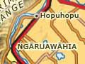


Ngāruawāhia
Town 19 km north-west of Hamilton with a 2013 population of 5,127. Ngāruawāhia’s name comes from a 17th-century love story. Te Ngaere, a Waikato chief, and Heke-i-te-rangi, a Ngāti Maniapoto woman, eloped. When their tribes were reconciled at a great feast, Te Ngaere began the festivities by saying, ‘Wāhia ngā rua’ (break open the food pits).
Ngāruawāhia has been an important Māori settlement for centuries. In 1858 the first Māori king, Pōtatau Te Wherowhero, was crowned there, establishing his headquarters on a point between the confluence of the Waikato and Waipā rivers.
Ngāruawāhia was occupied by troops after the battle of Rangiriri in November 1863, and was settled by Pākehā in 1864. Renamed Queenstown and then, in 1870, Newcastle, the town became Ngāruawāhia again in 1877.
An important port for steamboats plying the Waipā and Waikato rivers, in the 19th century Ngāruawāhia had a brewery, flour mill, flax mill, several sawmills and brick works. It was suggested that it could become the capital of New Zealand, but any hope faded when its growth stalled during the depression of the 1880s. Industries gradually closed in the 20th century. Many of the town’s workforce staff the Horotiu freezing works further south, or commute to Hamilton.
The first annual Ngāruawāhia Regatta, featuring Māori cultural activities as well as waka (canoe) races, took place in the early 1890s. It is still held in March each year, attracting huge crowds.
Tūrangawaewae
After making peace with the government in 1881, King Tāwhiao toured the Waikato region. On this journey he made a prophetic announcement:
Ko Arekahānara tōku hāona kaha
Ko Kēmureti tōku oko horoi
Ko Ngāruawāhia tōku tūrangawaewae.’ 1
(Alexandra (Pirongia) will ever be my symbol of strength of character, Cambridge a symbol of my washbowl of sorrow, and Ngāruawāhia my footstool.)
Tūrangawaewae, which literally means ‘footstool’, can also be translated as ‘a place to stand’. It was the name given to the Kīngitanga marae built at Ngāruawāhia in the 1920s.
Tūrangawaewae marae
Principal marae of the Kīngitanga, at Ngāruawāhia. In 1919 a Kīngitanga parliament house was built in the town, and in 1921 Te Puea Hērangi, grand-daughter of King Tāwhiao, inspired Kīngitanga supporters to build Tūrangawaewae marae. This fulfilled a prophecy of Tāwhiao that one day his people would return to Ngāruawāhia. The main meeting house, Māhinaarangi, was opened in 1929, and another, Tūrongo, in 1938. The Māori king frequently hosts visiting dignitaries there, and the marae complex is occasionally open to members of the public.
Hākarimata Range
Hilly range forming the western rampart of the middle Waikato basin. The name Hākarimata originates in the same feast that gave Ngāruawāhia its name. It refers to the mountain of food prepared for guests – ‘hākari kai mata’. The Hākarimata Scenic Reserve covers 1,850 hectares, and its tracks include the 12-km Hākarimata Walkway. Large beech and kauri tower over the forest canopy, and a strongly scented bush daphne, Alseuosmia quercifolia– unique to central Waikato – is found there.
Hopuhopu
Locality 6 km north-east of Ngāruawāhia. Hopuhopu was the site of an army camp from 1920, and many soldiers were trained there during the Second World War. In 1993 the land was returned to Waikato-Tainui, who built a complex including the Waikato-Tainui Endowed College and tribal administrative centre.
Taupiri mountain
Peak (288 m) at the junction of the Mangawara Stream and the Waikato River. The special burial ground of Waikato Māori, its summit is reserved for Māori kings and queens. In the 17th century the chief Te Putu had his pā on Taupiri mountain. After Te Putu was treacherously killed by another chief, Ngātokowaru, he was buried on the mountain and it became tapu (sacred).
Taupiri township
Settlement on the southern side of Taupiri mountain, 8 km north-east of Ngāruawāhia, with a 2013 population of 417. Until the 19th century an important pā, Kaitotehe, once the home of King Pōtatau Te Wherowhero, stood on the other side of the river. Nearby was Benjamin Ashwell’s Church Missionary Society mission station, which operated from 1842 to 1863.
Taupiri was settled by Pākehā in the 1870s, and became a farming centre with flax mills, a sawmill and, later, dairy factories. In the 2010s it has a significant Māori population.