Image
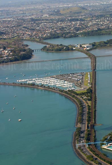
Named after William Hobson – New Zealand’s first governor – this bay is a tidal inlet. In the 1920s new transport routes were built to improve access to eastern Auckland. This view shows the eastern railway line (right) and Tāmaki Drive (left), with Meadowbank behind. In 2004 the Auckland City Council backed a plan to drive a multi-lane motorway across the bay, but it was defeated by strong public opposition.
Te whakamahi i tēnei tūemi
by Kellie Blizard
Permission of the New Zealand Herald must be obtained before any re-use of this image.