
Mosgiel
17 km west of Dunedin on the Taieri Plain, and with a 2013 population of 9,210, Mosgiel has been part of Dunedin city since 1989. It has a large population of retired people; 32.5% of its population was over 65 in 2006, compared with 15.7% for Otago as a whole.
Poetry of the racecourse
Poet Bill Manhire grew up in Otago and Southland, where his parents ran a series of pubs. He later studied at Otago University. His poem ‘Wingatui’ is a wistful evocation of the racecourse, with its birdcage (where horses parade before a race) and jockeys’ silks:
Sit in the car with the headlights off.
Look out there now
where the yellow moon floats silks across the birdcage.
You might have touched that sky you lost.
You might have split that azure violin in two. 1
Anzac Park is at the centre of the town. Holy Cross College, on the edge of Mosgiel, trained Catholic priests from 1900 to 1998. The Invermay agricultural research station dates from 1949. Nearby Wingatui is home to a racecourse and the start of the Taieri Gorge scenic railway. Taieri aerodrome is now used by light aircraft.
The woollen mills, established in 1871, closed in March 2000 because of competition from synthetic products and lower production costs in other countries. Now called Mill Park industrial estate, the buildings are home to a number of small businesses. A Fisher & Paykel dishwasher plant closed in 2008, and nearly 500 jobs were lost.
Outram
27 km west of Dunedin on the northern edge of the Taieri Plain, Outram is the centre of West Taieri. A township developed at the ferry crossing of the Taieri River on the route to the goldfields from 1861. Major J. L. C. Richardson, ex-British Indian army, local settler and one-time provincial superintendent, named the settlement after a fellow officer. The historic park at Outram Glen has a vintage machinery museum.
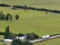
Allanton
24 km south-west of Dunedin on the South Island main railway, Allanton is on the Taieri Plain near Dunedin’s Mōmona airport. It was originally a settlement of 1870s immigrants, many of them Polish, who worked on building the railway. Later it became a centre for local farms.
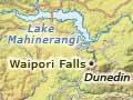
Waipori Falls
The houses of Waipori Falls village are tucked into the trees on a hillside near the falls, site of the main power station (one of four) for the Waipori scheme. The settlement is in the middle of the Waipori scenic reserve, a tract of native bush which extends some kilometres either side of the Waipori Stream. Waipori Forest, an exotic plantation, dates from 1924.
Lake Mahinerangi
Lake created by the hydroelectric scheme at Waipori Falls. The lake submerged the mining township of Waipori; it was named after Mahinerangi Barnett, the daughter of Dunedin’s mayor. The Edgar Stark bridge across the lake is named for its designer.
On high ground south of the lake are the Otago Pioneer Quartz and Pioneer Stream historic reserves, and the Canton battery, used to crush quartz so gold could be extracted. The former is the site of the first underground quartz mine in Otago, established in 1863.
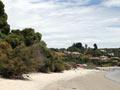
Taieri Mouth
Taieri Mouth is a holiday settlement at the mouth of the Taieri River; Taieri Beach is 3 km south. There is evidence of early Māori settlement at Taieri Mouth, including large cooking pits and human remains.