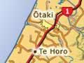


Kāpiti Coast
2013 population: 49,104
The Kāpiti Coast stretches for 30 kilometres from Paekākāriki to Ōtaki. It is named for Kāpiti Island, which dominates Wellington’s west coast.
The terrain consists of alluvial debris and windblown silt, overlaid by sand dunes. It was once covered with a mixture of dense coastal forest and extensive wetlands, but much of this was cleared in the 19th century for dairy and sheep farming.
Rapid growth
In the early 1900s the district developed as a series of seaside resorts. In 1940 Paraparaumu airport opened, handling passengers and freight for Wellington. Secondary industry developed at Ōtaki and Paraparaumu.
From the 1950s the more equable climate attracted retired Wellington people and commuters. House building boomed. In 1969 the Coastlands shopping mall opened at Paraparaumu. It was then among the few retail centres allowed to trade on Saturdays, and proved a magnet for the region’s shoppers.
In the early 21st century the Kāpiti economy was among the fastest growing in New Zealand. Growth was driven by the manufacturing, building and business services sectors.
Paekākāriki
2013 population: 1,665
The southern gateway to the Kāpiti coast is hemmed in by hills and sea. Immediately to the north lies Queen Elizabeth Park, Kapiti’s largest coastal reserve.
Paekākāriki (‘perch of the green parrots’) is popular with artists and writers, and retains some of its bohemian character despite increasing gentrification.
Paraparaumu
2013 population: 26,838
Paraparaumu has grown rapidly. It has expanded to include the nearby settlements of Raumati (to the south) and Ōtaihanga (to the north), creating a continuous urban area.
Paraparaumu is the administrative and commercial centre of the Kāpiti Coast. Its airport is an important regional facility, as is the sprawling Coastlands shopping centre, where the plethora of consumer goods belies the meaning of Paraparaumu – ‘scraps from an earth oven’.
At Paraparaumu Beach the view is dominated by Kāpiti Island, a world-famous bird sanctuary 5 kilometres offshore. Visitors leave from here to visit the island.
Waikanae
2013 population: 10,635
Waikanae is the second-largest settlement on the Kāpiti coast. In the early 19th century it was an important centre of contact between European and Māori.
Growing fast and old
Kāpiti’s rapidly growing population is putting pressure on its services, especially sewage and water. Between 1996 and 2013 the population grew by 27% (the national figure was 17%). It attracts retired people, and residents aged 65 or older made up 25.3% of the population in 2013 – twice the average for the Wellington region.
It is now known as a holiday and retirement centre – many of its residents are elderly. People retire there to garden on the rich alluvial plain created by the Waikanae River.
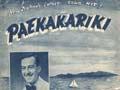
Ōtaki
2013 population: 5,778
Like Waikanae, Ōtaki was a site of contact between Māori and Europeans. The missionary Octavius Hadfield and Ngāti Toa chief Te Rauparaha together organised the building of the Rangiātea Church, opened in 1851.
In 2013 Ōtaki remained a distinctively Māori community, with more than double the national percentage of Māori residents.
Named by the legendary traveller Hau, who bestowed many of the names on the Kāpiti Coast, Ōtaki (where Hau ‘held his staff as he spoke’) is home to Te Wānanga o Raukawa, New Zealand’s first Māori tertiary educational institution. Founded in 1981, the wānanga (house of instruction) had 2,508 students in 2014. It is Ōtaki’s largest employer.
Ōtaki is also well known as a market gardening centre, supplying the capital with fruit and vegetables.