Image
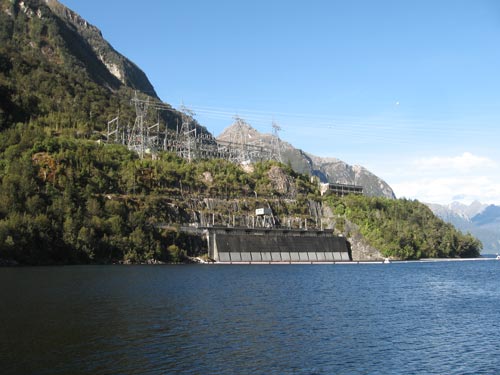
Only the upper levels of the Manapōuri power station can be seen – most of it is underground. Visible here are the intakes for the lake water that powers the turbines; the control building (upper right from the lake shore), which has lift access to the underground power-house; and the pylons which relay electricity to the grid.
Te whakamahi i tēnei tūemi
Flickr: kara_maloney's photostream
by Kara L. Maloney
This item has been provided for private study purposes (such as school projects, family and local history research) and any published reproduction (print or electronic) may infringe copyright law. It is the responsibility of the user of any material to obtain clearance from the copyright holder.