
Kōrero: Southland region

The Southland plains

Image
The Southland plains

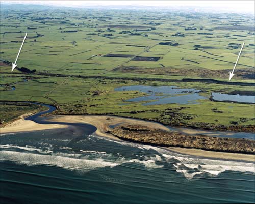
This view of the plains looks north from the mouth of the Waimatuku Stream, west of Invercargill. The arrows point to a coastline from 6,000 years ago – since then alluvial deposits have seen the coastline advance several hundred metres.

Te whakamahi i tēnei tūemi

GNS Science

Reference: CN43805/8

by Lloyd Homer

Permission of GNS Science must be obtained before any use of this image.

Ngā whakaahua me ngā rauemi katoa o tēnei kōrero

Me pēnei te tohu i te whārang

David Grant, Southland region – Geology and landforms, Te Ara – the Encyclopedia of New Zealand, https://teara.govt.nz/mi/photograph/20082/the-southland-plains (accessed 4 June 2026).

He kōrero nā David Grant, i tāngia i te 2 March 2009, updated 1 May 2015.