
Rākaihautū and Tamatea
Māori trace their arrival in Southland to the chiefs Rākaihautū and Tamatea. Rākaihautū, an ancestor of the Waitaha people, was a commander of the Uruao waka (canoe). Tamatea’s waka, the Tākitimu , was wrecked near Te Waewae Bay. In tradition, the Tākitimu Mountains are the upturned hull of the canoe.
The lower South Island was known as Murihiku, a name that loosely means ‘the tail end’ of the land.
Missing in the mist
Kaheraki, who was betrothed to Tamatea’s son Kahungunu, strayed from the party as they travelled past the Tākitimu Mountains. She was captured by the maeroero (spirit of the mountain) and never found again. But in later generations, some say they have seen her shadowy form through the mountain mist.
Coastal settlement
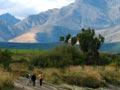
Before Europeans arrived, Murihiku Māori were largely hunter-gatherers. It was a tough existence, and probably no more than 200 people lived in the region.
It was too cold to grow kūmara (sweet potato). At first, moa and seals were the main source of food, but moa became extinct and seal numbers waned. It is likely that the people then moved between the interior and the coast, with permanent settlements on the coast at Waikawa, Bluff and Aparima (Riverton), and on Ruapuke Island.
From late winter into summer, groups moving inland would fish the rivers. Forest birds such as kākā, kākāpō, kererū, takahē and weka were hunted in the autumn. Hunters caught eels in the rivers and took tītī (muttonbirds) from islands off Rakiura (Stewart Island). Year round, the sea provided most food.
Tribes
The early tribe of Waitaha, including the sub-tribes Hāwea and Rapuwai, was assimilated into Ngāti Māmoe – newcomers from the north – through warfare and then intermarriage.
In the early 1800s the Ngāi Tahu tribe gradually incorporated Ngāti Māmoe.
The first Europeans
The British vessel Endeavour, captained by James Cook, explored the Southland coast in 1770. Cook named a number of features, including Doubtful Harbour (later Doubtful Sound) and Solander and Bench islands. He returned in 1773 and made contact with Māori in Dusky Sound.
Sealers first arrived in the 1790s. Within 30 years seals had been wiped out in the area, and the industry collapsed. But whaling took its place. By the 1820s a number of Europeans had become familiar with the shores and harbours of Fiordland and Foveaux Strait, and their Māori inhabitants. For another 20 years, Pākehā continued to pay relatively little attention to the interior, because of the rich pickings along the coast.
Whalers
Shipboard whalers worked the southern waters from the 1790s. Whalers based themselves on the shores of Foveaux Strait from the late 1820s. Shore-based whalers had more contact with Māori than those on ships. Intermarriage with Māori women strengthened bonds between the races – but Māori had no resistance to the diseases that Europeans brought.
The go-between
British sealer James Caddell was captured by Māori in 1810 and became the first European to live in the Foveaux Strait area. He married the chief’s niece Tokitoki, became a fluent Māori speaker, got tattooed, and was given chiefly status. Captain W. L. Edwardson of the Snapper was startled to meet a tattooed European when he put ashore in 1822 looking for flax. Caddell and Tokitoki accompanied Edwardson to Sydney, and taught him how to prepare flax. They later returned to Foveaux Strait.
Sealers and whalers initially supplied potatoes and pigs to Māori in exchange for flax and fish. Māori acquired whaleboats, which allowed them to fish as far away as the Auckland Islands (over 400 kilometres across open sea).
Invasion from the north
Whaling drew the interest of Māori tribes from further north. Warriors from Murihiku were involved in resisting Ngāti Toa chief Te Rauparaha’s invasion of the upper South Island.
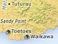
Only in 1836 did a war expedition reach the south. Te Pūoho, a Ngāti Mutunga chief and ally of Te Rauparaha, brought his war party through Haast Pass, with Ruapuke the goal. But the locals were forewarned. Led by Te Whakataupuka’s nephew Tūhawaiki, who had inherited his uncle’s mana, they intercepted Te Pūoho at Tuturau (near Mataura), killing him and taking many prisoners. Tūhawaiki was now the most powerful chief in the south.
Tūhawaiki signed the Treaty of Waitangi in June 1840. But within a few years he was dead, and the whaling stations had been abandoned.
European explorers
Frederick Tuckett scanned the Southland coast in 1844, seeking land for a Free Church of Scotland settlement. However, he decided on Otago Harbour, further north.
In 1850 Captain John Stokes of HMS Acheron, during its marathon charting of the New Zealand coast, climbed Bluff Hill and was excited by the view of ‘an extensive plain in form not unaptly compared to a bishop’s mitre … [a] vast expanse’. 1 Heading up the Ōreti River in a whaleboat, his surveyor, William Hamilton, was similarly enthusiastic. William Mantell, accompanied by William Stephen and Charles Nairn, followed the Waiau River inland. They were the first Europeans to explore Lakes Manapōuri and Te Anau.
The Murihiku sale
In 1852 Walter Mantell bought the Murihiku block – more or less today’s Southland – for the Crown from local Ngāi Tahu and Ngāti Māmoe. Reserves were never properly laid out, and Māori did not find a place in the new economy and society. Without land, and facing an influx of settlers, they were on the margins of the new world.