Image
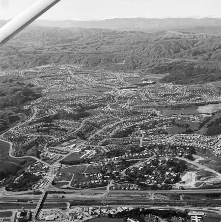
An aerial view of Eastern Porirua in the late 1950s highlights the ‘cut and fill’ technique of land development. Hills were topped or levelled and spill was used to fill gullies, making the once rugged landscape more rolling.
Te whakamahi i tēnei tūemi
Alexander Turnbull Library, Dominion Post Collection (PA-Group-00685)
Reference: EP-1976/3091
by Ian Chappell Mackley
Permission of the Alexander Turnbull Library, National Library of New Zealand, Te Puna Mātauranga o Aotearoa, must be obtained before any re-use of this image.
Comments
19 February 2024