Image
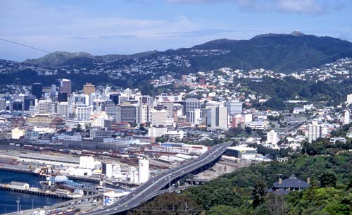
Hemmed in by hills, the main routes out of Wellington city run along the narrow western edge of the harbour, beside the Wellington Fault. In a major earthquake, the city could be cut off from help, with drastic consequences. Recognition of this led to the strengthening of the motorway flyover (foreground) in the 1990s.
Te whakamahi i tēnei tūemi
Private collection
by Chris Maclean
This item has been provided for private study purposes (such as school projects, family and local history research) and any published reproduction (print or electronic) may infringe copyright law. It is the responsibility of the user of any material to obtain clearance from the copyright holder.