


Click the names on the map to see photographs.
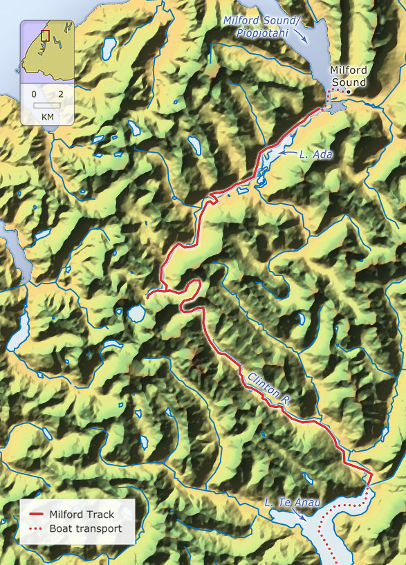
Many of those who walk the Milford Track spend their first night in Clinton Hut, the first version of which is shown here. After climbing to Mackinnon Pass – at 1,154 metres, the highest point on the track – they have the option of taking a short side track from Quinton Lodge to view the 580-metre Sutherland Falls, which when first seen by Europeans were thought to be the highest in the world. The track ends beside Milford Sound at Sandfly Point, where any delay in the arrival of your launch is likely to be painful.
Te whakamahi i tēnei tūemi
Te Ara - The Encyclopedia of New Zealand
This item has been provided for private study purposes (such as school projects, family and local history research) and any published reproduction (print or electronic) may infringe copyright law. It is the responsibility of the user of any material to obtain clearance from the copyright holder.