
Balclutha
Balclutha, dubbed the ‘big river town’ by its promoters, is on the Clutha River/Mata-Au, about 10 km upstream from its mouth. With a 2013 population of 3,918, it is the principal town of South Otago.
A ferry first plied the Clutha at Balclutha in 1852. The river was bridged in 1868, and a borough (town) council was formed in 1870.
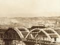
After severe flooding in 1878, floodbanks were built to protect the town. The Finegand freezing works opened in 1912. A high school and hospital date from 1925 and 1926. The existing six-span arched concrete bridge opened in 1935.
Balclutha’s population tripled between 1945 and 1976, from 1,500 to 4,500. Housing expanded up the slopes on both sides of the river. Livestock numbers soared; the kill count at Finegand peaked at 2 million in the 1984/85 season. Numbers have fallen since, and the town’s population has been static.
Four kilometres south, on the road to Ōwaka, the Telford Farm Training Institute was founded in 1964. Part of Lincoln University, Telford provides practical experience and technical training for students. The distinctive stone Otanomomo homestead is used as the administration building.
Clinton
Thirty-two kilometres west of Balclutha and 41 km east of Gore, Clinton had a population of 282 in 2013. Originally known as Popotunoa after the nearby bush-clad hill, it was named Clinton in 1873. Clinton was ‘dry’ between 1894 and 1956, when alcohol sales resumed.
Kaitangata
Twelve kilometres south-east of Balclutha, Kaitangata – ‘Kai’ to locals – had a 2013 population of 762. Coal was first mined in 1869, and was taken to Dunedin by rail from 1876.
An explosion in 1879 killed 34 miners. In the early 1900s, when the town had nearly 1,500 people, 440 men worked in the mines.
The last underground coal mine closed in 1970, but some opencast mining continued in the 2020s. Nearby Lake Tuakitoto is a wildlife sanctuary.
Stirling and Benhar
Stirling’s cheese factory opened in 1982. From the early 1880s Benhar was the site of the McSkimming brick, ceramics and porcelain factory, which closed after a fire in 1990.
Kākā Point
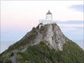
Twenty-two kilometres from Balclutha, close to Port Molyneux. Kākā Point was a port in the 1860s and 1870s, until rail linked Balclutha with Dunedin. There is a popular surfing beach; an unsealed road leads to the Nugget Point lighthouse. Acclaimed poet Hone Tuwhare (1922–2008) lived for many years at Kākā Point.
Ōwaka
Twenty-seven kilometres south of Balclutha, with a 2013 population of 303, Ōwaka is the main centre of the rugged Catlins district. Once a sawmilling town, it later became a centre for farming and tourism.
The Tahakopa branch railway reached Ōwaka in 1896 and Tahakopa in 1917. It closed in 1971. The tunnel hill walk follows the former rail line.
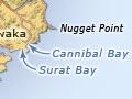
Sea lions can be seen at Cannibal Bay; Surat Bay is named after the Surat,which was wrecked there on 1 January 1874.
From Maclennan, a road goes up the Tahakopa River valley, and ultimately through to Wyndham.
Papatōwai
Papatōwai is an ecotourism centre. Tautuku, a surf beach, is 1 km further on, below Florence Head. The east side of the Tautuku estuary has a wetland walk; the west side, still forested, includes Lake Wilkie, a lake that formed behind sand dunes. Māori own land on the Tautuku Peninsula.
McLean Falls has a holiday park, café and bar. Cathedral Caves, a series of sea caves, can be visited at Waipāti Beach. Chaslands is named (and misspelt) after sealer and whaler Thomas Chaseland, like the nearby Chaslands Mistake.