
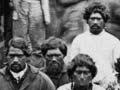


Māori had been living in New Zealand for nearly 400 years before Abel Tasman’s arrival in 1642. They had named every feature of the landscape, forming an oral map, often told as a narrative or genealogy. In some cases posts or piles of rocks were used to mark boundaries.
After European contact
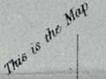
The first Europeans to explore New Zealand were assisted by Māori, who fed and sheltered them, and provided guides. In some cases they drew maps to translate their oral tradition into a visual form familiar to Europeans. At least 18 examples of this are documented. Maps were drawn in the sand or dirt, or occasionally marked on paper.
A 3-D map
John Chubbin, in 1856 one of the first Europeans to see Lake Wakatipu, described how Reko, a Ngāi Tahu rangatira living at Tuturau, showed him the route: ‘[H]e drew a map of the course of the Mataura [River] for me. He drew it in sand with a stick, the streams being represented by hollows and the mountains by little mounds of sand.’
Land purchases and surveyors
As Europeans settled and purchased land, Māori were drawn into the world of maps and survey plans. They helped establish the boundaries of the land they were selling, and some were employed as survey hands. Surviving maps of these purchases have sometimes become vital pieces of evidence in claims to the Waitangi Tribunal.
Resistance
As the number of Europeans increased and Māori concerns grew, surveyors often became the target of Māori resistance to land sales. In Wellington in 1840, when surveyors began to mark out the town on a new site at Te Aro, Māori pulled up survey pegs, protesting that they had not sold the land in question.
Similar incidents occurred elsewhere as Māori expressed disagreement about land sales or (later) anger at land confiscation. Forms of resistance included pulling up survey pegs, removing surveyors’ tools, sitting in the way of surveyors, burning fences and (occasionally) threatening violence.
Native Land Court
The Native Land Court was established in 1865 to assign individual titles to Māori land. Before a certificate of title could be issued, the land was surveyed, with the owners held responsible for paying the survey costs. The plan had to be drawn by a surveyor licensed to the court.
Maps of conflict
The conflicts that took place between 1845 and 1872 in Northland, Taranaki and Waikato were often triggered by issues related to land sales. As a result of the conflicts, a number of military maps were created. When war broke out in the north in 1845, the surveyor-general, Charles Ligar, produced a sketch map of the Bay of Islands and Hokianga, showing Māori paths, the pā of Ngāpuhi leader Hōne Heke Pōkai, and the location of a European gun battery and camp. Other plans, such as that of the pā at Te Ruapekapeka, were also compiled.
During the wars in Taranaki and Waikato, a number of maps were published showing paths, roads, European and Māori settlements, and the sites of redoubts. As in the northern war, the British navy charted waterways. Charles Heaphy, on board the Pioneer in 1863, drew a chart of the Waikato River from Whangamarino to Rangiriri. Maps showing confiscated land, and survey plans of military settlements with 50-acre farm lots, were also a result of the 1860–72 conflict.