


Early harbour charts
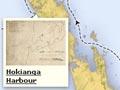
In 1826, around 30 potential settlers embarked for New Zealand on board the Rosanna, captained by James Herd. Herd had visited New Zealand previously and in 1822 had charted Hokianga Harbour.
Although the passengers did not find a suitable place to settle, Herd charted Otago Harbour, Port Nicholson (Wellington) and Port Pegasus (on Stewart Island). Port Nicholson was also charted by Captain Thomas Barnett, commander of the Lambton.
Sheet maps
A growing number of sheet maps of New Zealand were published in Britain, reflecting interest in the country as a place for settlement. The best-known and most accurate was produced by map publisher John Arrowsmith in 1841. Another, less accurate, map by Thomas McDonnell was published numerous times by James Wyld. In 1838 the Society for the Diffusion of Useful Knowledge published a chart based on McDonnell’s, with minor variations.
Early surveyors
By 1839, when large-scale European settlement began, New Zealand’s coastline had been charted, and some northern parts of the country sketchily mapped, but the rest of the land was undocumented.
Surveyors, working both for the New Zealand Company and for the Crown, mapped the land and laid out towns and roads. Reconnaissance surveys selected town sites and looked for arable land. Other early maps were cadastral – showing the land divided for the purposes of ownership and sale.
Tough work
The early surveyors often had a hard time. William Mein Smith, chief surveyor for the Wellington settlement, complained, ‘I have not the means of protecting either my instruments or plans from the wet’. 1 It was tougher for Robert Bain in south Westland, who took off his jacket one day and ‘found myself covered from head to foot with live maggots … it took me two days to get entirely rid of the vermin.’ 2
Town plans
Plans showing the layout of towns were drawn up by New Zealand Company and Crown surveyors. Influenced by contemporary ideas about town planning, the early planners often drew wide streets with land allocated for parks, public baths and other facilities.
Some town plans were drawn up ‘blind’, and sections were sold in Britain before they had been surveyed. Translating the plan to the reality of the topography sometimes proved difficult, and surveyors struggled to lay roads up steep hills, or through unmapped bush and swamp.
Geological maps
Gold was discovered on the Coromandel Peninsula in 1852, in Otago in 1861, and on the West Coast in 1864. As a result, provincial governments grew interested in New Zealand geology. The Austrian geologist Ferdinand Hochstetter and Julius Haast made the first systematic geological explorations from 1858.
Maps of their discoveries were published in Hochstetter’s 1863 Geological and topographical atlas of New Zealand. The New Zealand Geological Survey, established in 1865, sent out geologists to report on features, and in 1865 a geological map of the whole country was compiled by the director of the Survey, James Hector, based on information from various observations.
Base maps were often rudimentary, and geologists often had to create topographical as well as geological maps. From 1862, Haast employed surveyors on his expeditions to undertake the topographical work.
Provincial government surveys
The division between the Crown and the New Zealand Company led to several survey techniques being used. When the provincial government system was set up in 1853, each province had its own survey department while the central government controlled the survey and sale of Māori and Crown lands. While there were an increasing number of detailed maps of parts of New Zealand, they were sometimes inconsistent, and some survey techniques were less accurate than others.
Direct speaking
Major H. S. Palmer’s review of New Zealand surveying in 1875 did not mince its words. He described the state of Auckland surveys as one of confusion and neglect, and many Native Land Act surveyors as incompetent, ignorant and slovenly.
Major Palmer’s report
In 1874–75, Major H. S. Palmer, in New Zealand to observe the Transit of Venus, was asked by the government to review the country’s surveying and mapping. He concluded that only about 30% of the land had been adequately triangulated and only around 7% had boundaries accurately established. As a result, court cases over disputed boundaries and ownership were becoming more frequent.
Palmer recommended setting up a central government survey to create accurate cadastral maps (for selling and taxing land). In 1876, with the abolition of the provincial government system, the Department of the Surveyor-General was created. (It merged with the Crown Lands Department in 1891 to become the Department of Lands and Survey.)