
Cromwell
34 km north-west of Alexandra, with a 2013 population of 4,143, Cromwell is at the junction of the Kawarau and Clutha rivers. Since 1993 it is on the shores of Lake Dunstan, created by the damming of the Clutha River at Clyde, 27 km downstream; the old town was flooded by the project.
Gold in the river
A gold rush town, Cromwell was first called simply The Junction; it was renamed after the 17th-century English leader in 1863. Gold mining by individuals gave way to dredging by companies at the end of the 19th century, but by 1910 dredging had also waned.
Rail terminus
The population was no more than 600 between the two world wars, growing slowly to around 1,000 by 1966. Sheep farming and fruit-growing, the latter made possible by irrigation, were the main activities in the district.
A thriving new town
In the 1980s a new town was laid out to the west and north of the future Lake Dunstan, a by-product of the Clyde Dam project. Its shopping mall opened in 1985. Relocated buildings from the old town form a historic precinct at the end of Melmore Terrace. 70% of Otago’s vineyards are found in the Cromwell basin, including many of its premier pinot noir plantings.
Bannockburn
Former gold mining area, where the number of diggers peaked in 1867. Bannockburn was the site of dredging operations in the Kawarau River at the end of the 19th century, as well as a coal mine, horticulture and some small farms run by miners. In later years, churches and the school all closed (the latter in 1971). Since then a number of vineyards have been planted, and in 2009 the township had new houses and an art gallery. An extensive area of old gold workings is now a reserve.
Nevis Valley
Some kilometres south of Bannockburn a road climbs the Carrick Range, reaching 1,265 metres at its high point. This former gold-mining area was also once farmed, but is now largely deserted, though it is used for snowmobiling in winter. From near the Nevis headwaters a four-wheel drive route leads to State Highway 6 in Southland.
Kawarau gorge
The Kawarau River runs through a gorge for most of the way between the Arrow Basin and Cromwell.
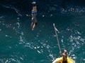
The A. J. Hackett Kawarau Bridge bungy, the world’s first commercial bungy jump, has been in operation since 1988. The gorge is also popular for jetboating and white-water rafting.
The Gibbston valley, in the Kawarau Gorge, is known for its pinot noir wines.
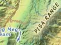
A small power station, commissioned in 1936, is located at the junction of the Roaring Meg stream and the Kawarau, about 10 kilometres upstream from the end of the gorge.
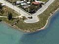
Lowburn
Lowburn was one of the last areas in Central Otago to have gold dredging operations. Lake Dunstan reaches as far as the Lowburn Flats.
Shrek the sheep
Shrek the Merino sheep, from Bendigo station, eluded musterers for six years. When he was caught for shearing in 2004 he was carrying a massive 27-kilogram fleece. The teachers and 13 children at tiny Tarras School wrote and published two books about the capture of Shrek to raise funds. The woolly protagonist was the guest of honour at the book launch, arriving in a stretch limousine; the first book sold more than 35,000 copies.
Bendigo
20 km past Cromwell on State Highway 8, Bendigo is reached via a short loop road. Starting as an alluvial mining area in 1862, from the 1880s to the 1920s it was one of the few successful quartz-mining areas in the province.