


Richmond
2013 population: 12,276
Richmond is the second-largest town in the Nelson region, and lies on the shores of Waimea Inlet at the junction of state highways 6 and 60. The fertile flat lands of the Waimea Plains, including Richmond, were a focus of early settlement. The town was surveyed in 1842 and was known as Waimea East until 1845, when tailor John Snow renamed it after his home town, Richmond-on-Thames in London.
Richmond has long been a favoured town for South Islanders to retire to. It grew considerably in the 1990s and 2000s, especially its eastern areas. The headquarters of the Tasman District Council are in Richmond. In 2013, 21.4% of the population was aged 65 or over, compared with 14.3% nationally.
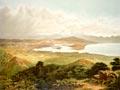
Waimea Plains
The Waimea River flows across the Waimea Plains into Waimea Inlet. Much of its water is taken to irrigate the rich, intensively cropped river soils of the fertile plains, which support market gardening, horticulture (mainly apples and kiwifruit), viticulture and farming. Increasing production will depend largely on irrigation, but in 2010 water takes were already over-allocated. A dam in the Lee catchment was being investigated to augment water supplies.
Appleby
Appleby was originally known as Waimea West, and was one of the earliest farming settlements of the 1840s. Māori had conditioned its rich soils for growing kūmara. Much of the land between Appleby, Richmond and Stoke was swampy, and it was decades before it was developed. In the 1840s Waimea West was accessed by boat to the mouth of the Waimea River.
Wakefield
2013 population: 2,106
Wakefield was originally known as Pitfure, but the name was changed to commemorate Arthur Wakefield, killed in the Wairau affray in 1843. There were two separate villages – Upper Wakefield and Lower Wakefield – but the town centralised around the railway station from the 1870s. St John’s Church (1846) is one of the oldest remaining Anglican churches in the South Island. Hops used to be grown around Wakefield, and disused hop kilns (used to dry the crop) can be seen in the surrounding countryside. However, in 2010 most of New Zealand’s hop crop was grown around Riwaka.
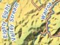
Brightwater
2013 population: 1,749
Brightwater, on the banks of the Wairoa River, was named after a water-powered flour mill there, and was one of the early villages serving surrounding farms. A railway station was built in the 1870s. Spring Grove , just south of Brightwater, was the birthplace of New Zealand’s best-known scientist, Ernest Rutherford. A memorial to Rutherford stands where Lord Rutherford Road meets State Highway 6. Spring Grove is also where brothers Tom and Harry Newman began their coach service.
Hope
2013 population: 1,149
Hope is a small town, just a kilometre south of Richmond on State Highway 6, originally named Ranzau by German settlers in the early 1840s. While the town’s name has changed, there is still a Ranzau Road, and German-language headstones at St John's Lutheran Church.