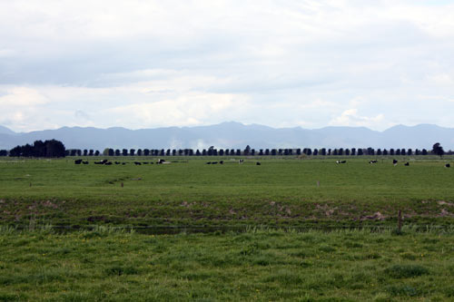
Level paddocks, a drainage canal, cows and lines of trees feature in this view of the plains taken from Pouarua Road, near Ngātea. The Coromandel Range is in the distance. In 1949 Maurice Duggan wrote about this area that he had: ‘stayed and slept cold and alone and afraid under a stiff tarpaulin ... riding on next morning, very early, the dew still on the grass, the cattle still some of them lying on the paddocks, the hills I would have to cross still night-shadowed.’ (Maurice Duggan, ‘Six place names and a girl.’ Landfall9 (March 1949), p. 8)
Te whakamahi i tēnei tūemi
Te Ara - The Encyclopedia of New Zealand
by Janine Faulknor
This item has been provided for private study purposes (such as school projects, family and local history research) and any published reproduction (print or electronic) may infringe copyright law. It is the responsibility of the user of any material to obtain clearance from the copyright holder.