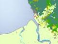

Because of its combination of mountains and lowlands, Hauraki–Coromandel has a wide range of local climates and native vegetation types for a coastal region in the upper North Island. At higher altitudes annual rainfall can be twice the volume and mean temperatures 7°C lower than on the plains. Subalpine plants occupy the summit of Moehau and regenerating conifer–broadleaf forests cover the lower slopes of the Coromandel Range, but little of the original kahikatea forest, flax and raupō survive on the Hauraki Plains.
Temperature
Summer temperatures are warm and winter frosts are light and infrequent in the lowlands. In the Waihou valley temperatures range from a daily average of 10°C in the winter to 19°C in the summer. In the mountains temperature falls rapidly with elevation. Te Aroha mountain has a yearly average of 8°C, compared with 14–15°C on the Hauraki Plains. The exposure of mountainsides to chilling winds further lowers temperatures.
Rainfall
Hauraki–Coromandel has a moist to wet climate resulting from elevation and exposure to rain-bearing winds. Annual rainfall varies from 1,150 mm in low-lying areas to 2,500 mm at higher altitudes.
Summer droughts result when anticyclones become stationary for extended periods. Sustained heavy rainfall occurs at higher altitudes as a result of intense cyclones. If soils are already saturated, runoff from the Coromandel and Kaimai ranges causes flooding on the plains.
The great flood of 12 April 1981
Despite 70 years of land drainage and river control, the Hauraki Plains was struck by one of the greatest floods in its 20th-century history in 1981. Thames was cut off by floodwaters for several days.
Once great forests
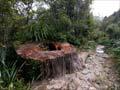
The Coromandel Range supported conifer–broadleaf forests, including stands of kauri, before the widespread logging and burning brought by European settlement. In recent times forest protection has reversed some of this destruction.
The canopy trees include rimu and rātā, with some miro, tōtara, kahikatea and mataī. Some large kauri have survived in steep, remote areas that loggers were unable to work, for example, at Manaia and Waiomu.
Regenerated native forest consists of rewarewa, kāmahi, kānuka and mānuka, with some pockets of small kauri.
Kahikatea swamp
Great kahikatea forests occupied the higher ground of the swamps of the Hauraki Plains before the arrival of Europeans. Flax, raupō, sedges and mosses occupied areas where water was permanent rather than seasonal. The Kōpūatai Peat Dome, west and south-west of Paeroa, is the only lowland ecosystem in New Zealand that remains substantially intact.
Animals and birds
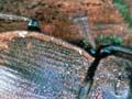
The Coromandel Peninsula is home to some distinctive fauna. Archey’s frog, one of four native New Zealand frogs, is only found in the Coromandel and part of the King Country. The Moehau stag beetle is found only in the northern part of the Coromandel Peninsula, in secluded, moist environments.
A number of the offshore islands are sanctuaries for birds. Whanganui Island in Coromandel Harbour is the site of a breeding programme for the endangered North Island weka. Along with Northland and the Marlborough Sounds, Coromandel is one of the New Zealand homes of the reef heron, a bird found throughout the western Pacific.
Possums, pigs and goats are the most common feral animals, the latter in sufficient numbers for hunting in some of the larger blocks of Coromandel Forest Park.