Image
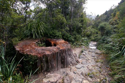
This massive kauri stump is a reminder of the forest clearance that took place in the Kauaeranga valley and other accessible parts of the Coromandel Peninsula between about 1860 and 1920. In 2010 only very small tracts of land on the peninsula still had original kauri forest.
Te whakamahi i tēnei tūemi
by Carmelo Aquilina
This item has been provided for private study purposes (such as school projects, family and local history research) and any published reproduction (print or electronic) may infringe copyright law. It is the responsibility of the user of any material to obtain clearance from the copyright holder.