-
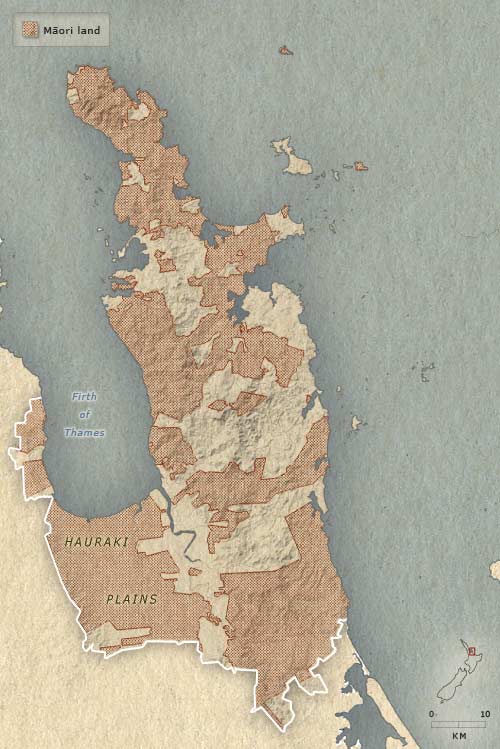
1875
-
1890
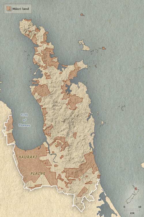
The biggest loss of Māori land on the Coromandel Peninsula took place after the Native Land Court started operations in 1865, and after gold mining gathered momentum a few years later. Between 1875 and 1890, as shown on this map, extensive areas of land were alienated in Ōhinemuri (in the south-east of the region), along the east coast of the Firth of Thames, and in the far north of the peninsula. Most land on the Hauraki Plains had passed out of Māori ownership by 1910.
Te whakamahi i tēnei tūemi
Te Ara - The Encyclopedia of New Zealand
This item has been provided for private study purposes (such as school projects, family and local history research) and any published reproduction (print or electronic) may infringe copyright law. It is the responsibility of the user of any material to obtain clearance from the copyright holder.