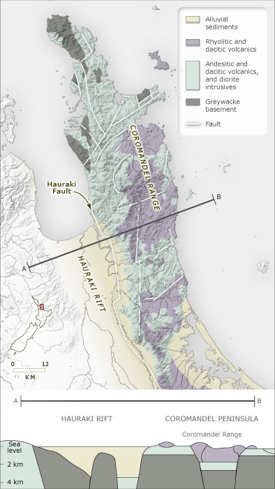
This cross-section of the region – from the Hapūakohe Range across the Hauraki Plains and the peninsula, along a line to the south of Thames and Tairua – shows how faulting has shaped the landforms. Faulting has created a pattern of alternating basin and uplift. The basin to the west of the Hauraki Fault has filled with sediment, while volcanic deposits have added to the uplifted landforms of the peninsula.
Te whakamahi i tēnei tūemi
Te Ara - The Encyclopedia of New Zealand
Source: R. G. Barker, Geology of the Coromandel Peninsula. Auckland: Pagez Productions, 1992, p. 2
This item has been provided for private study purposes (such as school projects, family and local history research) and any published reproduction (print or electronic) may infringe copyright law. It is the responsibility of the user of any material to obtain clearance from the copyright holder.