Image
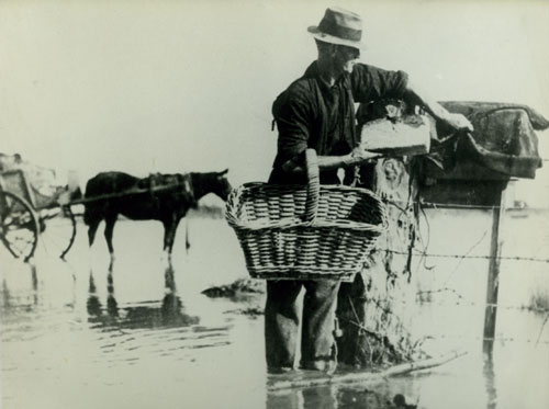
Mr J. White delivers bread to farmhouses cut off by floodwater near Paeroa after severe flooding of the Waihou River. Despite land drainage and river control works from the early 20th century, major floods occurred on the Hauraki Plains after heavy rainfall in the Coromandel and Kaimai ranges.
Te whakamahi i tēnei tūemi
Paeroa & District Museum
This item has been provided for private study purposes (such as school projects, family and local history research) and any published reproduction (print or electronic) may infringe copyright law. It is the responsibility of the user of any material to obtain clearance from the copyright holder.