Image
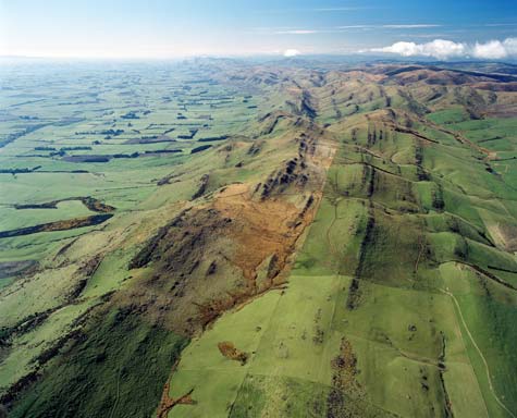
Eastern Southland lies on Murihiku rocks – muddy sandstone, gravel and volcanic ash, deposited 150–250 million years ago. Originally horizontal, these rocks have been tilted and folded by tectonic movements. Erosion has exposed harder bands, mainly compacted gravel, which extend for tens of kilometres.
Te whakamahi i tēnei tūemi
Reference: CN43841/16
by Lloyd Homer
Permission of GNS Science must be obtained before any use of this image.