Bay of Plenty
Known to Māori as Te Moana a Toi (the sea of Toi), this wide, northwards-facing bay was named by British explorer James Cook in 1769. Its long sandy beaches are broken by Tauranga and Ōhiwa harbours and several estuaries. The bay’s main islands are volcanoes: Mayor Island (Tūhua), Moutohorā (Whale Island) and Whakaari (White Island).
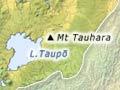
The Taupō Volcanic Zone
The Taupō Volcanic Zone is a region of active volcanoes, large and small lakes, and steaming geothermal areas, stretching 300 kilometres from Ohakune to Whakaari (White Island). Its landscapes have been fashioned – and sometimes destroyed – by volcanic activity over the last 750,000 years.
The southernmost part, in Tongariro National Park, is crowned by three large cone volcanoes – Ruapehu, Tongariro and Ngāuruhoe.
- Ruapehu, which last erupted in 1995–96, is the North Island’s highest mountain and has its only glaciers.
- Ngāuruhoe is a symmetrical cone that last erupted in 1975.
- Tongariro is a sprawling complex of volcanic vents of varying ages. Its irregular summit has varied and colourful craters, including Red Crater, the Blue Lake and Emerald Lakes craters, Te Maari craters and North Crater with its solidified lava lake.
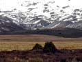
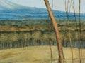
East of the three volcanoes, the Desert Road crosses the Rangipō Desert. This region lies in the mountains’ rain shadow (an area of reduced rain to the east) – but gets about a metre of rain a year, so it is not a true desert. However it has poor soils of ash and scoria, and is swept by drying winds, so it has unique alpine desert plants and bare areas.
Overnight sensation
On 10 June 1886, starting around midnight, Mt Tarawera erupted and transformed the landscape. In less than six hours, a series of craters were blasted, a colourful rift opened at the top of the mountain, and the world-renowned Pink and White Terraces were obliterated.
Ignimbrite volcanoes
North-east of the large volcanoes are a series of low-lying volcanic centres – Taupō, Maroa, Rotorua and Okataina. These serene landscapes were the site of catastrophic eruptions in the past, which blasted out vast amounts of debris and built broad plateaus of ignimbrite (a volcanic rock). The Kāingaroa plateau is now covered by one of the world’s largest man-made forests, mainly Pinus radiata (radiata pine).
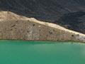
Calderas – huge volcanic basins created by the eruptions – are filled by lakes, including major ones such as Taupō and Rotorua. There are also many smaller volcanic peaks, such as Tarawera, which erupted in 1886, and Tauhara. On the edges of the calderas, powered by their underground heat, are New Zealand’s famous thermal areas, with their geysers, hot springs and mud pools.
Bush sickness
The flat plateaus of the volcanic region look ideal for sheep farming. But early farmers found that stock died from a wasting disease they called bush sickness. Agriculture was abandoned and the area was planted in exotic forests. The illness was later found to be caused by a lack of the trace element cobalt, easily corrected with fertiliser.
Taranaki and the King Country
Taranaki is dominated by the majestic 2,518-metre volcanic cone of Mt Taranaki (Mt Egmont). East of the mountain is the King Country and inland Whanganui, a region of steep hill country, deeply dissected by rivers.
Mt Taranaki is dormant – it last erupted about 200 years ago. It is the latest of several volcanoes on the site in the last half-million years. The eroded remnants of earlier volcanoes, the Kaitake and Pouākai ranges, lie north-west of Taranaki’s summit. Around these peaks are extensive lowlands, made of volcanic mud flows and lumpy rock debris, left when parts of the volcanoes collapsed.