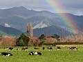
Havelock
Township with a 2013 population of 486, at the mouth of the Pelorus and Kaituna rivers and the head of Pelorus Sound. Havelock is 43 km north-west of Blenheim and 35 km from Picton via the winding Queen Charlotte Sound coastal drive. Havelock was the childhood home of two internationally important scientists, Ernest Rutherford and William Pickering.
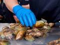
Streets were laid out in 1858, but it was the gold rush to the Wakamarina valley in 1864 that brought the township into being. Sawmilling was the principal activity until the 1910s, then dairying. Havelock has long catered to travellers on the Nelson–Blenheim highway, and is the base for many fishing, launch and recreation vessels using Pelorus and Kenepuru sounds. Since the 1970s a green-lipped mussel packing plant has been the town’s principal employer. Plantation forests are widespread through the valley.
Cullen Point and Māhakipawa scenic reserves face Havelock across the Kaituna River estuary. There is a coastal walking track and a lookout at Cullen Point.
Canvastown
Locality on State Highway 6, 10 km west of Havelock, at the junction of the Pelorus and Wakamarina rivers, which came into existence during the short-lived 1864 Wakamarina valley gold rush. The sudden arrival of thousands of miners created a ‘canvas camp’. Most miners moved on to the West Coast in 1865, but gold and scheelite continued to be mined up the Wakamarina valley for some years. The Wakamarina Track crosses the Richmond Range to Onamalutu Reserve in the Wairau valley. Te Hora is a marae of Ngāti Kuia, the tangata whenua of the Pelorus area.
Pelorus Bridge
The four-wheel drive Maungatapu track to Nelson across the Maungatapu Saddle starts 10 km upriver. In June 1866 the criminal Burgess gang attacked miners heading from the Wakamarina River to Nelson, killing five. There is a commemorative plaque at Murderers Rock, just below the saddle.
The Pelorus Track is a three-to-four-day tramp through Mt Richmond Forest Park. It follows the Pelorus River to its junction with the Roebuck Stream, then descends into the Aniseed valley road end, 29 km from Nelson city.
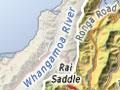
Rai Valley
Settlement and district on State Highway 6 on the Marlborough side of the Rai Saddle, 31 km north-west of Havelock and 49 km north-east of Nelson. Sawmilling gave way to dairying, with a dairy factory operating from 1909 until 1980. Rai Valley Area School teaches both primary and secondary students. Ōkiwi Bay and Te Aumiti (French Pass) are reached via Ronga Road, and Tennyson Inlet via Ōpouri Road.
Linkwater
Also known as Māhakipawa, a district 11 km east of Havelock on the road to Picton, adjacent to the former Māhakipawa pā. The Grove and Māhakipawa arms were once part of the same stretch of water, but alluvial deposits have built up a land barrier between them.
The first sawmill was set up in 1863; by 1870 the timber was largely worked out.
Boom and bust
Gold was found in Cullen Creek in May 1888. By the end of the year Cullensville had hotels, bakeries, blacksmiths, bootmakers, butchers, general stores, a hairdresser, hotels, restaurants, an oyster saloon, skittle alleys, billiards rooms, a bank branch, courthouse, post office and constable. Within 15 years the alluvial gold had been exhausted and the township vanished.
Gold was discovered in Cullen Creek, 2 km south of Linkwater, in 1888, producing a short-lived rush followed by intermittent mining ventures until the late 1930s. A dairy factory operated at Linkwater from 1911 to 1953. In the 2010s the Linkwater settlement had a school, store and church. Plantation forests cover many hillsides.
The Waikākaho–Cullen Creek Track follows old gold-miners’ tracks between the Cullen Creek valley and the south-flowing Waikākaho River, where gold was also worked in the late 1880s and early 1890s.
Ōkaramio
Settlement 20 km south of Havelock, on State Highway 6 in the Kaituna River valley. It lies near the watershed of the Kaituna and Wairau river catchments, and has a tavern and a hall. The Kaituna valley, the product of faulting, is a broad depression in Marlborough’s northern hill zone, flanked by the Richmond Range to the west and broken hill country to the east. Ōkaramio was an early staging post between Nelson and the Wairau for Newman Brothers’ horse-drawn vehicles.