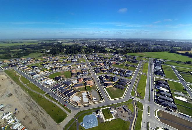
The development of this new subdivision at Rolleston began in 2012, with the expectation that eventually 1,000 sections would be created. Rolleston was initially planned by Norman Kirk’s Labour government in 1973, but it was not until the 1990s that development began. In 2001 the population of Rolleston was still under 2,000; by 2018 it had risen to around 17,000. Growth was particularly rapid after the February 2011 Christchurch earthquake, as people moved away from the damaged city. Rolleston was actually quite close to the epicentre of the 2010 Darfield quake, but suffered minimal damage and no liquefaction.
Using this item
Private collection
Courtesy of Hughes Developments Ltd
This item has been provided for private study purposes (such as school projects, family and local history research) and any published reproduction (print or electronic) may infringe copyright law. It is the responsibility of the user of any material to obtain clearance from the copyright holder.