Springfield
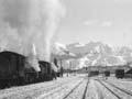
68 km north-west of Christchurch, Springfield is the last settlement on the plains before the main road west turns to cross Porters Pass. The railway to the West Coast veers off to begin its spectacular journey through the Waimakariri Gorge.
The Springfield Hotel was a coaching stop on the road west from Christchurch. When trains became the usual way to travel between Canterbury and the West Coast, the station refreshment rooms were well patronised. Water from the Kowai River, just beyond Springfield, was tapped in the 1870s to feed one of Canterbury’s early systems of stock water races.
Sheffield
Tiny farming settlement between Darfield and Springfield on State Highway 73, 9 km south-east of Springfield. Sheffield sits where the inland Highway 72 crosses the main road west. Its pub remains, but the once prominent railway station and goods shed have been removed.
Glentunnel
Settlement at the foot of the Malvern Hills, 15 km west of Darfield. It is notable, historically, as the location of the Homebush Brick and Tileworks. The nearby settlement of Coalgate takes its name from the area’s mineral resources. The Glentunnel Domain, by the upper Selwyn River, is a popular camping spot.
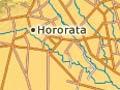
Hororata
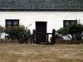
Settlement 7 km south-west of Glentunnel and just north of the Rakaia River. Hororata is the site of an early substation built when power began to flow from Lake Coleridge. Nearby are Coton’s Cottage, the restored cob dwelling of an early settler, and a church built in 1910 after the death of politician and premier Sir John Hall, as a memorial to his wife. The church was badly damaged in the Darfield earthquake of September 2010, as was the Hororata homestead.
Homebush
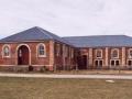
Locality 5 km east of Glentunnel. The Deans family, the first permanent European settlers on the site of Christchurch, also bought land near the Malvern Hills. At Homebush they farmed and ran a large brick-making and pottery works. The brick woolshed on Homebush marks the Deans family’s early presence in the district. The Homebush homestead was severely damaged in the September 2010 earthquake.
Selwyn River
River which flows 95 km from its source on the Big Ben Range to Te Waihora (Lake Ellesmere). Its Māori name is Waikirikiri. Several small rivers rising in the foothills between the Waimakariri and Rakaia rivers combine on the plains with the Selwyn. In summer, the Selwyn and its tributaries often run dry across the plains, but the rivers flood when rain comes from the south or east. The river was once a renowned trout fishery, and there are fishing cottages, known as the Selwyn Huts, near its mouth.
Where the wind blows
Darfield is often called ‘the township under the nor’west arch’. This refers to the arch of cloud that appears above the mountains to the west, when the north-west wind blows.
Darfield
Town 45 km west of Christchurch. Centrally located on the plains, it is an administrative centre. It has flourished, with the 1971 population of 830 increasing to 1,935 in 2013. Although isolated Canterbury rural towns are mostly in decline, those within commuting distance of Christchurch, like Darfield, have grown. Darfield was close to the centre of the 7.1 magnitude earthquake on 4 September 2010; the Greendale Fault was just to the east of the town. Although there was no loss of life, there was considerable damage to buildings in the Darfield district.