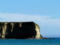
Napenape
Remnant of lowland coastal forest about 5 km south of the Hurunui River mouth, protected by spectacular limestone bluffs which reach into the sea. Archaeological sites identify Napenape as a place important to the early Māori of Canterbury. It has been accessible by road since the 1970s.
Motunau
Locality 33 km south-east of Cheviot. There is a group of fishermen’s houses and holiday cabins at the mouth of the Motunau River, 14 km south-east of Greta Valley. Offshore is tiny Motunau Island. Motunau was the site of the first sheep run in Canterbury, taken up in 1847. Fossils are found in the hills behind Motunau.
Greta Valley
Settlement at the Motunau turn-off on State Highway 1. Until the 1970s, there was no more than a school there, but in 1975 the local body decided to make a new township nearby. A tavern and shop opened and sections were sold, but Greta Valley never became as large as planned.
Scargill
Settlement 5 km north-west of Greta Valley. It developed after the railway arrived in 1902. Because it lies off State Highway 1, it has remained a small local centre. Its growth was checked when Greta Valley township was built nearby.
Waipara
Settlement and district at the junction of State Highways 1 and 7, 55 km south-west of Cheviot and 58 km north-east of Christchurch. It is the headquarters of the Weka Pass railway, a 12.5-km long section of the former Waiau branch line which closed in 1978. Excursions are now offered on a scenic stretch of the line. Extensive plantings of vineyards have made Waipara the main wine-making area in Canterbury.
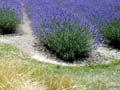
Waipara wines
Grapes were first planted in the Waipara valley in the 1980s. Some 28 wineries produce award-winning wines, especially pinot noirs and rieslings, noted for their intense flavours. There are over 1,200 hectares of plantings. Waipara has an ideal climate for grape growing, with high sunshine hours, hot dry summers and long autumns.
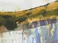
Waipara River
River draining the Okuku Range. State Highway 1 crosses the Waipara River just south of Waipara township. Above and below the highway, the river has carved small but spectacular gorges through limestone. Fossils of marine reptiles were first found in the river in 1859 and one, a mosasaur skull found in 2004, is thought to be 65 million years old.
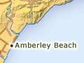
Amberley
Town on the northern bank of the Kowai River, 47 km north of Christchurch. It had a population of 1,575 in 2013, and is the headquarters for the Hurunui District Council. It owed its early growth to the railway line and its stockyards. Nearby Amberley Beach has holiday cottages. In Amberley there is a memorial to Second World War hero Charles Upham, who for many years had a farm at the mouth of the Conway River.
Ashley River
River, 90 km in length, that rises in the Puketeraki Range and flows into Pegasus Bay. Its Māori name is Rakahuri. Ashley Gorge is a popular picnicking and camping spot. Above the gorge, the river flows through Lees Valley, one of the region’s characteristic basins between mountains. Below the gorge, the Ashley flows across the plains north of Rangiora. Wetlands south of the lagoon at the river’s mouth once reached to Kaiapoi.
Leithfield
Settlement 4 km south of Amberley. Leithfield flourished until the 1870s, but was bypassed by the railway. After 1876 Amberley became the chief town in the district. In the 1950s, the main highway was re-routed east of Leithfield, but the township has just survived. Nearby Leithfield Beach is a holiday resort.