The earth’s surface is dominated by water, but only about 2.5% of the estimated 1.4 billion cubic kilometres is fresh water. Most fresh water (68.9%) is stored as snow and ice in glaciers and icecaps, while most of the rest (30.8%) is groundwater. Only 0.3% of fresh water is in rivers and lakes.
New Zealand’s water resources
New Zealand has abundant water resources in snowfields, glaciers, groundwater aquifers, rivers and lakes. It ranks in the top 10 countries in the world for both quantity and quality of water.
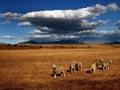
Despite this abundance, the country is facing growing challenges in managing its water. In the 2000s, demand for water was increasing dramatically as a result of urban expansion and agriculture. Water supplies were not always in the right places at the right times to meet these demands.
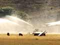
When demand exceeds supply – as is happening increasingly in drier, eastern parts of New Zealand – competition for water is fierce. These demands also peak during summer, when the water level is generally at its lowest. Climate change makes management of water resources even more complicated, as rainfall and snowfall patterns vary.
Extremes – floods and droughts
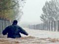
Too much water (floods) or too little water (droughts or low river flows) can both be a problem, and can damage property, livelihoods, roads and bridges.
Predicting floods and droughts
Knowing how often low flows are likely to occur is important for river water users such as irrigators, town water suppliers and hydroelectric generators. It can also help protect the ecosystem.
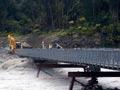
Similarly, knowing likely flood patterns aids with designing bridges, and protection works such as stopbanks and detention dams.
Flood of the century
Return periods for floods (of a certain size) and droughts (of a certain duration) are often expressed as a probability, based on historic records. For example, a one-in-100-year flood event means that, on average, a flood of that size will occur once every 100 years.
Annual extremes are analysed to estimate the probability of a drought or a flood.
Climate change is expected to affect the frequency of extreme weather events. For example, predicted changes in rainfall patterns on the South Island’s east coast are likely to increase the frequency of droughts – by 2080 droughts that currently occur about once in 20 years could come once in five years.
Flood models
Scientists are working to increase the warning period for floods, so impacts on infrastructure, stock and people can be reduced.
Flood models help predict when floods occur in relation to rainfall patterns, and the movement of flood peaks (the highest level of the flood) down through the catchment. Models also predict which areas are likely to be flooded, and can help in designing and planning flood control work.
Costs of extremes
Floods and droughts are New Zealand’s most damaging and costly natural hazards. For example, the 1984 Southland floods and 2004 Manawatū floods are estimated to have cost the economy over $100 million each. The Canterbury drought of 1987–88 had an estimated cost of $360 million, while the 1998–99 Otago drought probably cost the economy $600 million.