Water movement
The hydrological cycle describes the movement of water in the environment. Water is constantly moving, and is easily transformed from ice to water to vapour.
The sun’s energy drives the hydrological cycle. It evaporates water from oceans, other water bodies and plants. Water vapour returns to earth as rain, hail, fog, sleet and snow. Water moves downhill through glaciers, streams, aquifers (underground water), rivers and lakes. It moves at differing speeds, depending on whether it is in a solid or liquid state, and on the landscape through which it drains. For example, glacier ice moves very slowly – an increase in snowfall at the head of the glacier can take 5–8 years to be reflected in the position of the glacier face. In contrast, small streams can rise within minutes of heavy rainfall.
Water balance studies
A water balance study explains and quantifies the hydrological cycle for a particular region or catchment, by measuring various components of the cycle. Some components, such as rainfall, stream flow and groundwater level, are relatively easy to measure. Others, such as water vapour in clouds, evapotranspiration (water loss from plants and soil) and soil moisture, are more difficult to measure.
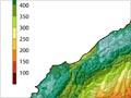
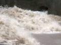
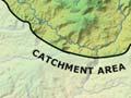
An added complexity for these studies is that measurements need to be adjusted to account for New Zealand’s mountainous terrain, which makes it problematic to use rainfall recordings from one rain gauge to characterise rainfall over the entire river catchment, which could be 100 to 1,000 square kilometres in size. Also, rainfall patterns can vary dramatically over relatively small areas of a catchment. For example, during floods in Manawatū in 2004, some parts of the catchment received downpours while other parts had very little rain.
Human influences
The hydrological cycle is strongly influenced by topography, geology, soils and vegetation. However, it can also be modified through human activities, such as taking water for power generation, industry, agriculture and water supply; discharges into rivers; construction of dams; changes in vegetation patterns (such as planting pine forests); and changes in the shape of the riverbed. For example, streams in urban areas often swell rapidly after rainfall because of stormwater drainage from impermeable surfaces such as roads or car parks.
At times of low flow, urban streams also tend to dry up more quickly than non-urban streams. Paved surfaces in urban areas reduce the amount of water seeping into groundwater, much of which would normally then be slowly released into rivers or streams. Groundwater often makes a major contribution to the flow of a river or stream.
Catchment management
Water resources are managed to minimise human impacts on the natural hydrological cycle.
In New Zealand, water is managed by catchment, so regional councils are able to concentrate on the entire contributing area for a whole river catchment or aquifer. It is rare for water to be transferred from one catchment to another. However, one example is the Tongariro power scheme, which takes water from the Whanganui River catchment and diverts it to the Waikato catchment.