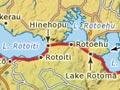
Lake Rotoiti
Lake Rotoiti’s full name, Te Rotoiti-kite-a-Īhenga, links it to Īhenga, the early ancestor from the Te Arawa canoe, who is credited with exploring the lakes district. The lake is graced by Matawhaura, a forest-covered mountain at its eastern end.
Rotoiti is really two lakes in one. The eastern part sits in the north of the Okataina caldera (volcanic depression), and has many hot sulfur springs. The western half – a drowned valley, Te Awa-i-Takapuwhaia – was formerly an outlet for Lake Rotorua. The two lakes today share an outlet at Rotoiti’s western end.
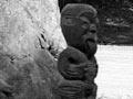
Māori history
A number of war expeditions passed the lake from the 1820s to the 1860s, including one led by Ngāpuhi leader Hongi Hika in 1823, and East Coast King movement supporters in 1864.
Many sub-tribes, most of them linked to Ngāti Pikiao, have rights around the lake. Ngāti Pikiao gifted land to the Crown in 1920, ensuring that much of the lake shore has remained undeveloped.
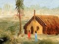
There are many marae on State Highway 30 between Tapuaekura and Tapuaeharuru, along the south-east shore of the lake. Moose Lodge, where Queen Elizabeth II was welcomed on a number of occasions, is just east of Tapuaekura marae.
The long and readily fortified Ōhoukākā peninsula, on the northern side of the lake, featured in much tribal history. To its east is Tokerau marae and to its west Ōtaramarae, also the name of an affluent nearby holiday settlement.
Lake Rotoehu
Lake 35 km north-east of Rotorua city. Like Lakes Rotoiti and Rotomā, Rotoehu formed when lava blocked a series of valleys in the north of the Okataina caldera. Like Lake Rotomā, Rotoehu has no surface outlet; its inflow of water is matched by underground outflow.
The area around the lake is farmed and forested. There are just two areas of holiday houses, on the eastern shore.
In 1823, musket-armed invaders from the north arrived, led by Ngāpuhi chief Hongi Hika seeking revenge for earlier killings. They brought canoes to Lake Rotoehu from Maketū, dragging them overland to Lake Rotoiti and along its shores before attacking Te Arawa at Lake Rotorua. The stretch of land they pulled the canoes over is known as Hongi’s Track, as well as by its Te Arawa name, Te Ara-o-Hinehopu (Hinehopu’s path).
Lake Rotomā
The easternmost of the Rotorua lakes, Rotomā occupies most of a small caldera, its drainage blocked by lava flows. It is partly surrounded by native forest, which also lines the highway leading east to the Bay of Plenty. The landscape changes as the traveller leaves the volcanic lakes behind, descending to the intensively farmed Rangitāiki plain with the Bay of Plenty in the distance.
There are no marae on the shores of Lake Rotomā today, but Ngā Motu peninsula on its western side, between Te Rotoiti and Whangaroa inlets, was well settled in the 19th century.