Image
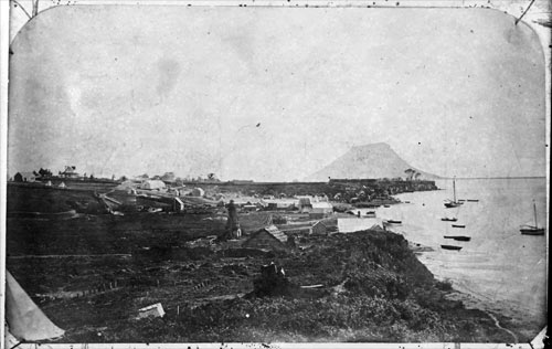
This early photograph was taken about the time of the battle of Gate Pā (1864), and shows houses at what would become the town centre of Tauranga. They are flanked by the Monmouth and Durham redoubts (forts), with the distinctive profile of Mt Maunganui (Mauao) rising behind.
Te whakamahi i tēnei tūemi
Reference: 1/2-022640; F
Permission of the Alexander Turnbull Library, National Library of New Zealand, Te Puna Mātauranga o Aotearoa, must be obtained before any re-use of this image.