Image
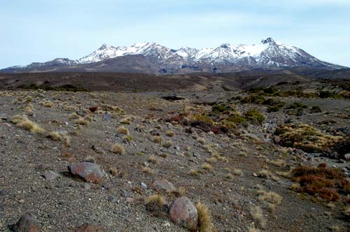
Tussock and shrubs grow in the rubbly path forged by a lahar (volcanic mud flow) from Mt Ruapehu. The heat of volcanic eruptions can melt snow and ice. Meltwater mixes with rocks and soil and sweeps down established channels, destroying all vegetation and anything else along the way.
Te whakamahi i tēnei tūemi
Reference: 10057760
by Herb Christophers
This item has been provided for private study purposes (such as school projects, family and local history research) and any published reproduction (print or electronic) may infringe copyright law. It is the responsibility of the user of any material to obtain clearance from the copyright holder.