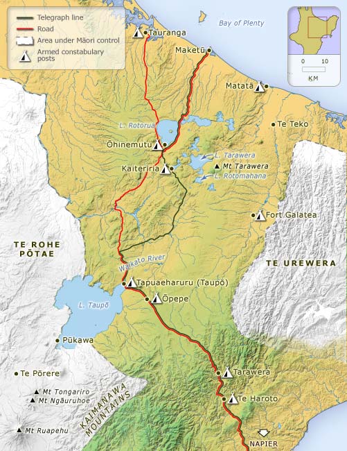
Roads were built and telegraph lines laid across the middle of the North Island in the 1870s, isolating the Māori strongholds of Te Urewera in the east and Te Rohe Pōtae (the King Country) in the west. ‘The true weapons of conquest,’ said Governor George Bowen in 1872, ‘are the spade and the pickaxe’ (Appendix to the Journals of the House of Representatives 1872, A-1, p. 86).
Te whakamahi i tēnei tūemi
Te Ara - The Encyclopedia of New Zealand
This item has been provided for private study purposes (such as school projects, family and local history research) and any published reproduction (print or electronic) may infringe copyright law. It is the responsibility of the user of any material to obtain clearance from the copyright holder.


Tāpiritia te tākupu hou