

Early human impact
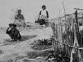
People first settled on the Volcanic Plateau around the early 1300s. They burnt forest to clear land for cultivation, and by the 19th century the vegetation was mostly tussock, fern, mānuka and similar plants.
Vegetation
The forests that survived, on the higher reaches and south faces of the ranges, are mostly conifers, notably tōtara, rimu, mataī and miro. The largest forested areas are along the Hauhungaroa Range, west of Lake Taupō, and the Kaimanawa Mountains to its south-east. Pureora Forest, in the Hauhungaroa Range, is home to the rare kōkako (wattlebird).
Heather was planted in Tongariro National Park in the early 20th century to provide habitat for introduced game birds, but soon became an invasive weed.
Landscape
On Mts Ruapehu, Tongariro and Ngāuruhoe, barren lava flows, snowfields and hot springs exist side by side. Because of the high altitude of the land around the central volcanoes, the landscape is stark – early European settlers described it as desert.
Lakes
The lakes shaped patterns of early settlement. Most people lived close to fresh water, or geothermally heated water and steam. They settled around the shores of Lake Rotorua and nearby lakes, and at the northern and southern ends of Lake Taupō.
Forests, farms and electricity
In the first half of the 20th century, large tracts of the plateau were planted in exotic pine forests. This was to replenish New Zealand’s timber resources, depleted after large areas of native forest were cleared.
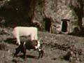
Early farmers found that stock died from a wasting disease called bush sickness – later discovered to be caused by a lack of the trace element cobalt. When this was added to the soil, from the 1930s, the land became productive pasture.
From 1929, the Waikato River was dammed to produce hydroelectricity, creating a series of lakes. Power stations using geothermal energy were built from the 1960s, and natural geothermal activity reduced.
Urbanisation
In 1950, around 10,000 people lived on the shores of Lake Rotorua, and 5,000 beside Lake Taupō; by 2000 the numbers had risen fivefold and sixfold respectively. The growing population increased pressure on geothermal areas, as steam was diverted for domestic and commercial use. This sometimes led to a serious decline in natural geothermal activity.
Threats to lakes and rivers
Urbanisation has led to lakes being polluted with sewage, although treatment plants now deal with much of this hazard.
For many years sawmills poured chemical waste into rivers, but these discharges are now treated. The Waikato River continues to have high levels of arsenic, most of it discharged from the Wairākei power station.
Runoff from fertilised farmland has added large amounts of nutrients to the lakes. This leads to rapid growth of lake weed and algae, so a lake could eventually become anoxic (lacking in oxygen), and effectively dead. In 2006 the cost of saving Lake Rotorua was estimated at $200 million.
Māori environmental concerns
In 1978 the Ngāti Pikiao people made a successful claim to the Waitangi Tribunal against a proposal to dump Rotorua’s waste in the Kaituna River. Ngāti Tahu lobbied to limit the impact of the Ōhaaki geothermal project on their lands.