
Te Karaka
Township 30 km inland and north-west from Gisborne on State Highway 2, with a population of 480 in 2013. Te Karaka is located on the right bank of the Waipāoa River and, despite the distance inland, is only 40 metres above sea level. It is the largest settlement between Gisborne and Ōpōtiki, 112 km further north-west. It was the headquarters of Waikohu County between 1908 and 1989, and had its own town council from 1917 to 1962. From Te Karaka, State Highway 2 follows the old rail line west to Matawai.
In 2013 nearly one-third of the population was aged under 15 years, and three-quarters identified as Māori, with most belonging to local iwi Te Aitanga-a-Māhaki. Primary industries provided the main source of employment. Te Karaka primary school and Waikohu College combined as Te Karaka Area School in 2011.
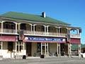
In the early 2000s Te Karaka had a petrol station, medical centre, hotel and shops.
Whatatutu
Settlement 15 km north of Te Karaka on the right bank of the Waipāoa River, close to its junction with the Mangatū and Waingaromia rivers. In the early 2000s Whatatutu had a school, fire brigade and marae. The headquarters for Mangatū forest was located 21 km further north, on Armstrong Road. The forest was first established as part of a soil-conservation strategy in the 1960s.
Petroleum has been found in the area, but not in commercial quantities. Te Pakake-a-Whirikoka was a site known to Te Aitanga-a-Māhaki, and samples from it were tested as early as 1866. The search for more profitable sources continues around Whatatutu.
Ōtoko
Locality on State Highway 2, 22 km west of Te Karaka and 18 km south-east of Matawai. The Ōtoko walkway follows 5 km of the Gisborne–Moutohorā railway line, which closed in 1959 – the tracks were removed the following year.
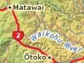
Matawai
Settlement 70 km north-west of Gisborne and 40 km north-west of Te Karaka on State Highway 2, near the headwaters of the Motu River. The Motu drains into the Bay of Plenty to the north, but its upper reaches are farmed districts on the East Coast side of the Raukūmara Range.
Matawai was originally a sawmilling settlement, becoming a farming centre as the native bush was felled. In 1932 a new road to Ōpōtiki was opened through the Waioeka gorge. Matawai was at the junction of the old and new routes. In the 2000s Matawai was a popular stopping place for travellers on the state highway.
Motu
Settlement 13 km from Matawai on Motu Road, the original route from Gisborne to Bay of Plenty. Still in use, the road reaches the Bay of Plenty coast at Ōmarumutu, 52 km from Motu. The mountain-bike section of the Motu Challenge, an annual 172-km multisport event, traverses the old Motu Road.
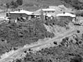
The Hansen family were the first settlers to clear land at Motu, in 1888. They built a slab whare (house made of slabs of timber) which became a half-way house on the bridle track to Ōpōtiki. The Hansens opened the first Motu Hotel in the early 1890s, and part of the slab whare became the first Motu School in 1896.
Other settlers followed. In December 1906 no fewer than 300 applicants entered a ballot for 323 hectares of bush-covered land on steepish hills. The successful applicant, a Mrs Marshall, was married to an engineer on the railway line.
Sawmills operated from around 1900 to the 1930s, by which time most of the millable native trees had been felled.
A busy place
In the 2000s Motu is a quiet place, but that was not always the case. In the 1910s it was recorded that ‘when the train came in at night about 6 o’clock on a nice summer evening there would sometimes be up to 500 people at the station’.1
A coach road to Bay of Plenty opened in 1914, and the hotel was rebuilt and enlarged. The rail line reached Moutohorā, 4.5 km south of Motu, in 1917, but never went further. With the opening of the Waioeka gorge road in 1932, Motu became a backwater. The hotel was shifted to Matawai in 1934.
James Whinray, a Gisborne borough councillor, convinced the government to set aside some land for a bush reserve. The 429-hectare Whinray Scenic Reserve abuts the spectacular Motu Falls and is home to a kiwi population.