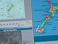


Computer modelling
Data collected from observations of weather conditions is entered into a computer modelling system, which performs billions of calculations to predict future atmospheric conditions. These are displayed as isobar maps at the earth’s surface and throughout the atmosphere. They show variations in temperature, humidity, wind, divergence and convergence of air streams, and derived variables such as vorticity (the rotation of air) and upward motion. Fine-scale models covering New Zealand and its immediate surroundings are embedded within global models and provide a better resolution of features over the country.
Beyond about four days, the computer model returns an increasing number of errors. To counter this, the model can be run many times for the same situation using slightly different initial conditions to create an ensemble of predictions.
Public forecasts
Forecasts for radio, television or newspapers are summaries of expected conditions, concentrating on temperature, rainfall, snow, storms and cloud.
Aviation forecasts
Forecasts for the aviation industry are more complex. Airport forecasts contain details of the expected amount and height of clouds, variations in visibility caused by rain, changes in wind speed and direction, and the likelihood of fog or thunderstorms.
Forecasts of conditions en route include wind speed and direction at various altitudes, and the probability of turbulence or conditions that would cause ice to build up on the aircraft.
Marine forecasts
Marine forecasts concentrate on wind speed and direction, wave height, and visibility. Wind speed over the sea can be stronger than over the land, and direction can also differ significantly. New Zealand meteorologists forecast conditions around the coastline and are responsible for a large part of the South Pacific Ocean, from longitude 150° east to 120° west between latitude 25° and 55° south.
Extreme weather
MetService issues warnings of extreme weather – for heavy rainfall (more than 100 millimetres in 24 hours, or 50 millimetres in six hours over an area of more than 1,000 sq km), severe gales over land, and snowfall greater than 25 centimetres in 24 hours. Forecasts are made on request for search and rescue operations and in the event of forest fires. There are specialised forecasts for mountain areas like the Homer Tunnel in the South Island, where the risk of an avalanche is high. Thunderstorm hazard maps are posted on the MetService website.