
Hāwera
Main town and rural service centre for the southern Taranaki region, with a 2013 population of 8,517. Hāwera is 70 km south-east of New Plymouth and 90 km north-west of Whanganui.
Hāwera on fire
A major fire destroyed many buildings in Hāwera’s town centre in 1895. It started when a lamp fell over in a drapery store and spread from building to building – 17 were destroyed, including the Egmont Hotel, the new post office and the headquarters of the town’s newspaper. Two people were killed, both of them occupants of the hotel.
History
The town takes its name from the Māori village Te Hāwera, which was near Whareroa, south-east of the present town. In 1866 a government military base was established, and the town grew up around a blockhouse in the early 1870s. Its population increased by over 60% between 1878 and 1886.
Dairy farming and processing have been a mainstay of Hāwera’s economy since the late 19th century. The giant Fonterra milk-processing plant at Whareroa, a kilometre south of the town, is the largest single-site dairy factory in the southern hemisphere. Petroleum finds – the Rimu/Kauri and Kupe fields – and their associated developments have also maintained the town’s economy. Hāwera’s population grew rapidly in a time of rural prosperity after the Second World War (from 4,840 in 1945 to 8,142 in 1966) but has been relatively static since then.
Local writer Ronald Hugh Morrieson presented a dark, seamy version of mid-20th-century Hāwera in his novels. Many locals found his descriptions offensive. An attempt by fans to save his house from demolition in 1992 failed, partly because of this. It is now the site of a KFC restaurant.
Picnic at the pā
The large historic pā of Turuturumōkai is 2 km north of Hāwera. The pā, with its impressive earthworks, was a popular picnic place in the mid-20th century, and had a swimming pool and kiosk. At the eastern end of the reserve, within the earthworks of Turuturumōkai redoubt, is a memorial to the 10 men of the garrison who were killed during an attack by Tītokowaru’s forces under the command of Haowhenua in 1868.
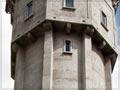
Heritage and recreational facilities
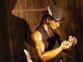
Parks include King Edward Park and Naumai Park, a small bush and lake reserve. The town’s iconic concrete water tower was completed in 1914. The Elvis Presley Memorial Record Room, in a converted garage, has thousands of rare recordings and memorabilia of ‘the King’.
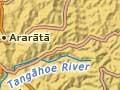
Ararātā
Rural settlement on an elevated marine terrace 12 km north-west of Hāwera.
Normanby
Rural settlement 7 km north of Hāwera, with a 2013 population of 888. Normanby was named after the second Marquess of Normanby, governor of New Zealand from 1874 to 1879. The township was established in the 1870s, but the earlier Waihī military post had been established in 1866 by Lieutenant Colonel Thomas McDonnell. The massive wooden stockade and blockhouses were on the high ground overlooking the tiny Waihī cemetery and an old pā site, Mangamanga. The post was manned by troops until 1885.
In the cemetery is a memorial to the Pākehā soldiers killed in 1868 at Turuturumōkai and Te Ngutu-o-te-manu. The Normanby domain was the site of the 1879 Ketemarae redoubt, and is the site of another memorial to Pākehā casualties of the 1868–69 conflicts.
The Ngāti Ruanui marae of Ketemarae is 2 km north-east of Normanby. One of the meeting houses here, Kumea-mai-te-waka, officially dates from 1902, but includes some structural elements from a much earlier house.
Big birds and people
Ōhawe was one of New Zealand’s productive moa-hunter sites. It was first recognised as ‘a regular necropolis’1 by the Reverend Richard Taylor in 1843 during one of his pastoral walks. W. D. B. Mantell followed in 1847 and was the first to recognise that humans and moa had co-existed here. In 1866 Taylor returned with Governor George Grey to collect specimens.
Ōhawe
Coastal settlement 8 km west of Hāwera at the mouth of the Waingongoro River. Ōhawe is one of New Zealand’s earliest settled places. The first people hunted several species of moa and other birds here about 1300 CE.
Ōhawe township was founded as a military settlement. In 1865 troops under the command of General Duncan Cameron reached the river as they advanced up the west coast from Whanganui. Two redoubts were constructed – one on each side of the rivermouth. Many of the British and colonial troops who died in the later battles are buried in the cemetery at Ōhawe.
The short-lived ‘Republic of Hāwera’ was based in Ōhawe. It was founded by James Livingston in 1879 out of frustration at the lack of government action after Te Whiti’s followers ploughed up his land. Volunteers patrolled the area and prevented further ploughing.
Mokoia
Rural settlement 10 km south-east of Hāwera, founded as a military settlement. Commissioned in 2002, Swift Energy’s production station for the Rimu/Kauri oil field was constructed on the coastal terrace between the Tangahoe and Manawapou rivers.
Tāwhiti Museum
Museum 3 km north-east of Hāwera, based in the former Hāwera Dairy Company’s Tāwhiti branch factory. The museum’s founders and creators, Nigel and Teresa Ogle, have constructed an impressive series of exhibitions about local history using life-sized figures and scale model panoramas.
Taiporohēnui Marae
Large Ngāti Ruanui marae north-east of Hāwera. Taiporohēnui has a wharenui (meeting house) called Whareroa. An earlier marae here was razed by government military forces in 1866.