Image
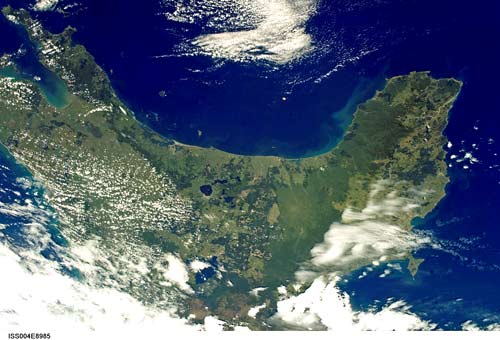
This satellite image shows the long curve of the Bay of Plenty coastline from Waihī Beach to Cape Runaway, punctuated by the major harbours of Tauranga and Ōhiwa. White Island is just visible in the centre of the bay.
Te whakamahi i tēnei tūemi
Reference: International Space Station Crew Earth Observations Experiment and the Image Science & Analysis Group, ISS004_ISS004-E-8985
This item has been provided for private study purposes (such as school projects, family and local history research) and any published reproduction (print or electronic) may infringe copyright law. It is the responsibility of the user of any material to obtain clearance from the copyright holder.