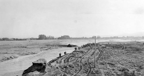
Flood-control efforts in the Wairau River valley culminated with the opening of the Wairau diversion on 30 April 1963. The diversion established a course for the Wairau River which ran from State Highway 1 at Tuamarina directly across country to Cloudy Bay. The usual course of the river meandered for some kilometres south-east before reaching Cloudy Bay at Wairau Bar, and was unsuited to handling surges of water.
Te whakamahi i tēnei tūemi
Marlborough Historical Society, Marlborough Museum & Archives
Reference: 000.900.1003
by Norman Brayshaw
This item has been provided for private study purposes (such as school projects, family and local history research) and any published reproduction (print or electronic) may infringe copyright law. It is the responsibility of the user of any material to obtain clearance from the copyright holder.
Comments
07 September 2020