Image
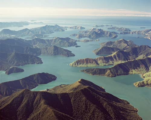
At the end of the last ice age, around 14,000 years ago, the sea level rose and drowned many coastal valleys of the mountainous area that is now the Richmond Range. The range had tilted to the north-east during a much earlier mountain-building period. In this image Nydia Bay, Māori Bay and the middle or Hikopu reach of Pelorus Sound are in the foreground (left to right) and Rangitoto ki te Tonga (D’Urville Island) is at top left.
Te whakamahi i tēnei tūemi
Reference: 10381/28
by Lloyd Homer
Permission of GNS Science must be obtained before any use of this image.