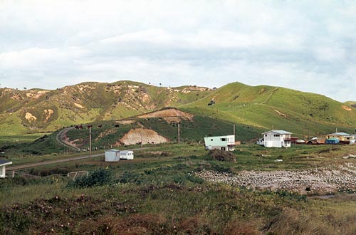
Skippers Ridge, in the background of this photo from the mid-1970s, was – along with nearby Sarahs gully, out of the picture to the right – the site of archaeological excavations in the late 1950s which first found evidence of early Polynesian settlement in the North Island. The seagull-covered dunes in the foreground are the site of a midden – rubbish dump – of shells and other materials of archaeological interest. Tahanga (211 m), a hill out of the picture to the left, was the principal source of the basalt used for tool-making by Māori throughout the upper North Island.
Te whakamahi i tēnei tūemi
University of Auckland, Department of Anthropology, Anthropology Photographic Archive
Reference: 023/M_4_135_001
This item has been provided for private study purposes (such as school projects, family and local history research) and any published reproduction (print or electronic) may infringe copyright law. It is the responsibility of the user of any material to obtain clearance from the copyright holder.
Comments
08 May 2017
04 May 2017