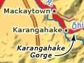
Paeroa
Town 22 km south of Thames with a 2013 population of 3,888. Paeroa is at the junction of State Highway 2 and State Highway 26, and of the Waihou and Ōhinemuri rivers. State Highway 2 links Paeroa with Auckland and Tauranga, State Highway 26 with Thames and Hamilton.
Beginnings
The lower Waihou was an area of dense Māori settlement. The first European settler, Joshua Thorp, acquired land at Ōpūkeko (near present-day Puke bridge) in 1839, to which he and his family moved in 1842. Downriver the earliest buyers included L. A. McCaskill at Hikutaiā.
On the opening of the Ōhinemuri goldfield in 1875, the river junction was the obvious site for a town. Paeroa was born, but payable gold was not found and the town languished.
Golden years
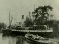
The introduction of the cyanide process and resultant goldfield boom turned Paeroa into a busy river port in the 1890s. Heavy machinery, coal and miners’ supplies came by river to Paeroa wharf, and were then hauled by horse teams to the mines at Karangahake, Waikino and Waihī.
The first wharves were on the Ōhinemuri River, close to the business centre. Silting caused by gold mining forced the building of a new wharf at the junction with the Waihou River. A tramway was needed to convey goods the 3 km into the town. Dumping mining debris into the Ōhinemuri also exposed Paeroa to flooding, notably in 1910.
The branch rail from the main trunk line reached Paeroa in 1895 and Waihī in 1905. Paeroa became one of the largest railway freight junctions in the country. Most passengers continued to arrive and leave by river steamer until river silting made that difficult.
Nearby Mackaytown, at the entrance to the Karangahake Gorge, thrived during the heyday of gold mining.
20th century onwards
In the 20th century farming replaced mining as the mainstay of the town. One of Hauraki’s first butter factories was built at Paeroa in 1901. Butter and milk-powder production continued until the 1980s, when company mergers led to the building of larger, more centralised plants.
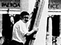
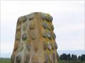
In the 2000s Paeroa is primarily a service centre for dairy farms. It is also known for Lemon and Paeroa (L & P), a carbonated drink, which was originally made using water from a local mineral spring. In the early 2000s it was made artificially by Coca-Cola Amatil in Auckland, but a 7-metre-high replica of an L & P bottle remains an iconic landmark.
Ngāti Tamaterā have two marae in Paeroa, at Taharua and Te Pai o Hauraki.
Kopuatai Peat Dome
The 10,201-ha wetland reserve west of Paeroa is the largest intact restiad (rush) peat bog and the largest freshwater wetland in New Zealand. It was registered under the Ramsar Convention (international register for protection of wetlands) in 1989, not least because it is one of the few homes of the giant cane rush (Sporadanthus ferrugineus).
The lower Waihou
The narrow fringe of lowlands on the eastern side of the Waihou River between Paeroa and Thames is made up of a series of alluvial fans deposited by rivers flowing westwards from the Coromandel Range.
From 1867 Māori supporters of the Māori King movement in Hauraki resisted European expansion south of Ōmāhu (between Pūriri and Hikutaiā), but in 1882 the chief Tukukino allowed a road to be built through Kōmata.
Gold was found at Maratoto in 1887 and in the Kōmata valley in 1891, but in quantities much smaller than those of the Karangahake and Waitekauri finds. Mining ended at Kōmata in 1913 and at Maratoto in 1927.
Flooding remains a risk, as in 1960 when a break in the Waihou stopbank caused the Kōmata–Hikutaiā basin to flood. River management and farming have taken a heavy toll on the archaeological evidence in the area.